"Hittites"? As Emeritus Professor of Asian and Middle Eastern Studies at the University of Pennsylvania, James D. Muhly, remarked:
"The first thing to realize about the Hittites is that they are not Hittites. The sad fact is that we are stuck with an incorrect terminology, but it is too late to do anything about it now. This unfortunate situation came about as a result of several deductions made by earlier scholars which, though entirely reasonable at the time, have proved to be false. The Bronze Age civilization of Central Anatolia (or Turkey), which we today call Hittite, completely disappeared sometime around 1200 B.C. We still do not know exactly what happened, though there is no lack of modern theories, but that it was destroyed, of that there can be no doubt."
"Because we continually see things from the Greek point of view, we tend to assume that Greece was always the center of events and that everyone else knew of and was concerned with Greek affairs. Yet, seen in proper historical perspective, Greece was, in all periods prior to the conquests of Alexander the Great, a remote and peripheral area, on the very fringes of the civilized world,… "
More properly, they were NëꞋshan-Speakers, in Central Anatolia (modern Turkey).
Prior to NëꞋsha, Only Modern Toponyms Are Known For Ancient Sites
≈12 - 9 Ka (BCE 10,000–9,000), Hallan Tchemi — In SE Turkey; a small early PPNA sedentary site in SE Turkey with domestic structures and ritual deposits that represent some of the region’s earliest village life and symbolic behavior.
≈11.5 - 10.2 Ka (BCE 9,500–8,200), Jerf el‑Ahmar — A long PPNA→PPNB sequence on the Euphrates fringe showing communal buildings, early architectural experimentation, and ritual practices linking mobile foraging to settled life.
≈11.6 - 10.2 Ka (≈BCE 9,600–8,200), Göbekli Tepe — One of the earliest large‑scale monumental ritual centers, with carved T‑shaped pillars and enclosure architecture reflecting organized communal ritual work.
≈11.3 - 9.9 Ka (≈BCE 9,300–7,900), Tell Qaramel (Aleppo region, NW Syria) — Early monumental/towered architecture and communal features that parallel other earliest PPNA ritual/defensive constructions.
11 - 10 Ka (≈BCE 9,000–8,000), Karahan Tepe/Sefer Tepe: — Sites with T‑shaped pillars and rich carved reliefs closely related stylistically to Göbekli Tepe and part of the same regional monumental tradition.
10.5 - 10 Ka (≈BCE 8,500–8,000 BCE), Nevali Tchori — A PPNB settlement with anthropomorphic stone pillars and sculptural work that bridge large communal ritual architecture and increasingly domesticized village contexts.
≈10.3 - 9.4 Ka (≈BCE 8,300–7,400), Bōnjūklū Hōyūk — An early Konya Plain (Central Anatolia) Neolithic village showing developing house plans and practices that are ancestral to later Çatalhöyük social and domestic patterns.
≈10.2 - 9.4 Ka (≈BCE 8,200–7,400) Ashikli Hōyūk — A central Anatolian Neolithic settlement with well‑preserved domestic architecture and evidence for sustained sedentism and craft specialization preceding TchatalHōyūk.
≈10.2 - 8 Ka (≈BCE 8,200–6,000), Tchayōnū — A long‑running Upper Mesopotamian Neolithic village complex notable for architectural innovation (grill‑plans, cells) and gradual shifts toward permanent domestic communities
≈10 - 7 Ka (≈BCE 8,000–7,000), Pınarbashı‑type occupations — Regional Late Neolithic/Incipient-Pottery Neolithic sites in the Konya Plain — requiring the development of budding trade routes — and surrounding areas that show transitional material culture toward Fully-Pottery Neolithic tels. Ever blossoming and expanding trade routes snaked down major rivers (e.g., the Euphrates and Tigris), establishing trading port-colonies through Mesopotamia and the modern Arab-Persian Gulf, venturing down the coastline to Indian ports, simultaneously around modern Saudi coastline (taking larger and deeper-water shortcuts to points in India.
Simultaneously, trade routes blossomed, snaking directly out of Anatolia south further down the eastern Mediterranean coastline of A•dãm•ãhꞋ, and island-hopping discoveries. Cyprus was certainly encountered and colonized by this time. First island-hopping, finding and colonizing a port on TzūrꞋ Island, then modern Crete; conquering the Mediterranean seaway to Kᵊmët—and ports throughout Southern Europe and up the Atlantic coastline as far as the Scandinavian coastal ports followed. Did they, at some point, learn to use the navigational properties of the Iceland Spar Sun-Stone? What we know is, that the ᴷHat•tūꞋsha built sea-worthy ships and, along with their later confederates, the TzūrꞋ, conquered Mediterranean sea crossings to Kᵊmët, the 2 confederate mariner Naval Superpowers becoming so well known that were simply referred to as the "people from the sea". Like "Minoans" and "Natufians", "Sea Peoples" are modern-imagineered designations that never existed in antiquity.
Increasingly deeper shortcuts from ports in Anatolia to southern ports in the eastern Mediterranean required building generationally ever more seaworthy ships. As their ships ventured around Saudi coastlands in the (modern) Gulf of Oman, Arabian Sea and Gulf of Aden into the Red Sea, they visited both Western Saudi and East African coasts of the modern Red Sea (soon favoring more lucrative ports along the east African coast) up to the port of Ë•tzi•ōnꞋ Gi•bōrꞋ ((modern) Ī•latꞋ (Eilat), southernmost port, on the Red Sea, in Israel)—by the time of ShᵊlōmꞋōhha-MëlꞋëkh (Born ≈BCE 1100, crowned ≈BCE 1080, age≈20, died ≈BCE 1040, age≈60).
Tchatal Hōyūk (Çatalhöyük) Typical home interior (archaeologically restored on site)
≈9.1 - 7.7 Ka (≈BCE 7,100–5,700), TchatalHōyūk. — A large Pottery Neolithic to early Chalcolithic (Copper-stone/ore) tel on the Konya Plain characterized by dense domestic neighborhoods, rich symbolic assemblages, and long‑term sedentary urbanizing trends.
Typical Interior: Central room, oven below the ladder for cooking, heating. Raised platforms in rooms for sleeping. Beneath, they buried their recently deceased. Above were public streets, communal & rituals areas.
TchatalHōyūk’s main occupation is Neolithic → early Chalcolithic (≈BCE 7100–5700, primarily ≈BCE 7100–6000). NëꞋsha (Kültepe/Kanesh), by contrast, is a (mix ≈12% tin with copper→) Bronze Age site with major occupation in the early BCE 2ⁿᵈ millennium (Old Assyrian period) ≈BCE 2000–1700, absorbed into ᴷHat•tūꞋsha in the BCE 2ⁿᵈ-1ˢᵗ millennium. Thus, the technology of the earliest documented ancient/original village toponym — NëꞋsha — was roughly 3,500–5,000 years more advanced than Çatalhöyük! Not so much a wonder that, by then, they had advanced beyond these digs to indoor plumbing and sea-going ships, merchant & naval, routinely sailing trading routes across the Mediterranean and over half the then-known world! (All villages and cities prior to NëꞋsha are named with modern toponyms.)
Nor is it much wonder that they hugged the Atlantic Coast as far north as modern England, and perhaps Scandanavia—with its birefringent, polarizing pre-compass navigational Sun-Stone (Iceland spar).
All this demonstrates graphically how much was lost, how dystopic the event, of the TzūrꞋ Eruption and its consequent centuries of LBAC! Scientists & engineers today still can't figure out how some of the large stones were cut, much less cut to such exquisite dimensions, much less lifted into Göbekli Tepe, the pyramids or Israel's Great Temple!
8.5 - 6 Ka (≈BCE 6,500–4,000) Yarim Tepe (in Mesopotamia) & 𒌷=YᵊꞋri•ᵏhhō — Regional Late Neolithic → later Chalcolithic developments across Anatolia and northern Mesopotamia, expanding south by ships down the Tigris & Euphrates Rivers through Kinnat ("The Gulf"—probably Babylonian term—modern Arab/Persian Gulf). Continuing through Ūr around the time of the birth of Av•rãm, it could only have been ᴷHat•tūꞋsha technology and engineering that enabled construction of the Ziggurat—dated to that time (and since no other civilization of that era was technologically capable)!
Extending their same expansion of their many advanced technologies from Kinnat ("The Gulf"), exploring profitable trading possibilities southward, still hugging the coastlines, into the (modern toponyms) Arabian Sea, Indian Ocean, then west to the Gulf of Aden, through the Strait of Tears NW plying both coasts of the Red Sea north to Ë•tzi•ōnꞋ Gi•bōrꞋ (modern) Ī•latꞋ (Eilat), southernmost port, on the Red Sea, in Israel. Thus, negating the previously hypothesized problem of transporting ship materials overland from the Mediterranean Sea, the ᴷHat•tūꞋsha simply sailed them to their destination port for ShᵊlōmꞋōhha-MëlꞋëkh — and those ships were seaworthy! By contrast, when (Mᵊlãkh•imꞋ Bæt 22) Yᵊhō•shã•phãtꞋ Bën-ÕsãꞋ, MëlꞋëkhYᵊhūdꞋãh, and A•khazᵊyãhꞋū Bën-Akh•ãvꞋ, MëlꞋëkhYi•sᵊr•ã•eil´ partnered to copy and reproduce their own to sail to Ophir for gold, probably using local wood, it was a disaster. The entire fleet failed before even getting clear of the harbor!
In this same time frame, the ᴷHat•tūꞋsha had developed their shipbuilding technology in the Mediterranean Basin into a Naval and Merchant Marine Monopoly Seapower.
By this stage, perhaps 2 millennia before they built the 1ˢᵗ (Cheops) Pyramid in Kᵊmët (again, no other civilization existed that was technologically capable), they were simultaneously building, commissioning and dispatching merchant (and Naval as needed) ships throughout the Mediterranean coasts of S Europe and sailing the Atlantic coastline north as far as Britain/Ireland—finally explaining the celestial engineering required to orient the tomb-passage entrance so that sunrise of the winter solstice exclusively permits an ≈17 minutes beam of sunlight to illuminate an inner chamber (Newgrange: County Meath, Ireland ≈5.2-4.9 Ka) and Scandinavia—perhaps learning of Icelandic spar pre-compass navigational Sun-Stone, further finally explains how their seaworthy-technology ships are known to have been routinely sailing to Cyprus, to Crete and then to Kᵊmët. Together, we learn how it could only have been their advanced technology building, or supervising the work of, the 1ˢᵗ, Cheops, step pyramid, the Great Pyramid, and the immense stones of the Great Temple of ShᵊlōmꞋōhha-MëlꞋëkh! Confounding Arts-degreed European supremacists, the first advanced knowledge, technology and engineering was introduced by the ᴷHat•tūꞋsha civilization—not, 2-5 millennia later, Greek arrogaters!!!
≈5.126 Ka (≈BCE 3126) 1st Known (Pre-ParꞋōh) King of Kᵊmët: Narmer
≈4.707–4.711 Ka (≈BCE 2688–2664) ParꞋōh Djoser Step-Pyramid
≈3.25 Ka (≈BCE 1250) Earliest documented (Kᵊmët) reference to A•dãm•ãhꞋ as Kᵊna•anꞋ — Ergo, to Avᵊrã•hãm, living a century earlier, we can only say with certainty that it was A•dãm•ãhꞋ; with Kᵊna•anꞋ perhaps being merely the northern region (below modern Lebanon/Syria) confederated with the "Sons of Heth" on the south.
------------------------
Anatolia @ Britannica AI (https://www.britannica.com/place/Anatolia/The-Neolithic-Period): mid-8th to the mid-7th millennium Neolithic settlement (Çatalhüyük/Catal Hüyük) where 'world's oldest bread' discovered: "houses were built of sun-dried brick, closely contiguous like the cells of a honeycomb, but each had several rectangular rooms similarly planned and was accessible only by a wooden ladder from its flat roof. The contiguous roofs provided space for the communal life of the inhabitants. Some of these buildings appear to have been religious shrines, elaborately ornamented with heads or horns of animals, either real or imitated in plaster. The walls were decorated with coloured murals, repeatedly repainted after replastering, and some designs closely resembled the cave paintings of the Paleolithic Period. As a source of information about the activities, appearance, dress, and even religion of Neolithic peoples, these paintings are of great significance. Other arts and crafts were well attested. Human and animal figurines were carved in stone or modeled in clay. Bone was used for tools and implements, sometimes with finely carved ornamentation. Weapons included polished maces, arrows, and lances with tanged obsidian heads. Impressions of mats and baskets were found, as well as implements used in spinning and weaving. Miraculously, fragments of actual textiles were recovered and preserved. The presence of Mediterranean shells and of metal ores and pigments not locally available suggests extensive trade." Wiki: "Some skulls were plastered and painted with ochre to recreate faces, a custom more characteristic of Neolithic sites in Syria and [YᵊꞋri•ᵏhhō] than of sites closer by. Vivid murals and figurines are found throughout the settlement on interior and exterior walls. Distinctive clay figurines of women, notably the Seated Woman of Çatalhöyük. … Predominant images include men with erect phalluses, hunting scenes, red images of the now extinct aurochs (wild cattle) and stags, and vultures swooping down on headless figures.[47] Relief figures are carved on walls, such as of lionesses facing one another. … Female figurines have been found within bins used for storage of cereals, such as wheat and barley, and the figurines are presumed to be of a deity protecting the grain. Peas were also grown, and almonds, pistachios, and fruit were harvested from trees in the surrounding hills. Sheep were domesticated and evidence suggests the beginning of cattle domestication as well. However, hunting continued to be a major source of food for the community. Pottery and obsidian tools appear to have been major industries; obsidian tools were probably both used and also traded for items such as Mediterranean sea shells and flint from Syria."
Hattusha German ArchInst home 1155x1160.png @ https://archive.is/pvmY
Hattusha German ArchInst Excavations Hattusa 1160x1185.png @ https://archive.is/7oRtu
Hattusha German ArchInst Brief Hist Hattusha-Bogazkoy 1160x1510.png @ https://archive.is/8x3Q
Hattusha German ArchInst Hittites Forerunners Followers 1160x5650.png @ https://archive.is/Dt5B
The "Hittite" vs "Hethite" Problem
Scholars are divided whether חִתִּים (ᴷHit•imꞋ, "Het"-ites), sons of חֵֽת "ᴷHæt", who lived in the vicinity of Khë•vᵊr•ōnꞋ and, by the Biblical era, were reported living all around the north and east regions of the Mediterranean Basin as well as Anatolia, were part of the Kit•imꞋ. When one takes into account the geotectonic factors of the previous 5 megaannia, then it seems more difficult to explain how those out of Africa, Egypt, Anatolia and the Arabian peninsula could have been not autochthonous to these lands. When you read or hear "Hittite", they were, in Hebrew, the
'✡ MSHK•T•Y (Semitic Hebrew, read rtl), MHכִּתִּי, Kit•iꞋ, pl. Kit•imꞋ); southern coastal province of ᴷHatᵊtūshꞋa on the northern coast of the Eastern Basin of the Mediterranean Sea (i.e. the Mediterranean coastland of modern Turkey).
MH:כִּתִּים (Kit•imꞋ), popularly \’\’Kittim\’\’ (because of the dagesh in the ת); indigenous Anatolians (of ancient western Turkey) & colonists of both Cyprus and Crete (e.g., Knossos) Islands.
Pronunciation of Kit•imꞋ is distinguished from Khit•imꞋ only by the דָּגֵשׁ (dã•gæshꞋ, the little dot in the middle of the letter), which wasn\'t added until ≈10th century CE—after the extinction of spoken Hebrew (click this link, then \'\'more\'\' link in glossary entry). כִּתִּים probably derived from כָּתַת (kãt•atꞋ, to beat down, pound, crush).
כִּתִּים (Kit•imꞋ) should not be confused with the Kᵊna•an•imꞋחִתִּים (Khit•imꞋ, sons of Khæt), transgarbled via LBAC Dark Ages Greek to Latin to English conflation of \’\’Hethites\’\’ & \’\’Hittites\’\’.
','#dfefff', 340)"; onMouseout="hideddrivetip()">𐤊𐤕𐤉 of the Ta•na״khꞋ!
The NëꞋshan-Speakers Descended From Gondwanan-Anatolia
Not "Hethites", Nor Mythical "Minoans", Nor Misnomer "Hittites"!!!
NE Mediterranean & Anatolian (Western Turkey) Geological Zones & Fault Lines (Photo credit: Donna Whitney, UMinn)
𒄩𒀜𒌅𒊭 (ᴷHat•tūꞋsha; endonym of LBAC Anatolian (W Turkey) NëꞋshan language speakers—the 1ˢᵗ land & naval architecture super-culture & seafaring world superpower. (Lacking seaworthy ships for naval power, Mi•tzᵊr•ayꞋim was limited to an African rival power.)
The NëꞋshan cuneiform was transliterated into BH:, which evolved into MSH:mytk.
It is unlikely that the two were confused in BH. The (MH:כִּתִּים)—notice that … is not easily confused with …—were autochthonous to Anatolia, having evolved there from (pre-human) Gondwana, Pangea times; whereas the BH: (MH:בְּנֵי־חֵת) descended from (i.e. the 2ⁿᵈ son of) the (Semitic-speaking) Kᵊna•anꞋ, son of , having also evolved there from (pre-human) Gondwana, Pangea times.
Based on the Hellenized Greek transgarble in the Septuagint, Χετταῖοι, this was thereafter widely then conflusenced with "Hethites" of Kᵊna•anꞋ by Christian-, followed by Muslim-era clergies, religious arts-degreed historians & archaeologists grinding their respective religious axes.
In Hebrew, this evolved into MH:כתים / ᴷHit•imꞋ — colonists of both Cyprus and Crete (e.g., Knossos) Islands.
Still later, when the Vikings were discovering America in the 10ᵗʰ century CE, the Masoretes first vowelized this into כִּתִּים / Kitᵊt•imꞋ; Biblical "Kittim"—today a thorough muddle called "Hittites" (and, beginning in early 1940s CE, called by an Arts-degreed adventurer (imagineered, non-existant) "Minoans").
6 Ka/≤BCE 4 Millennia—Who Was More Advanced Than Kᵊmët, Builders Of The Great Pyramid ()?
Kᵊrē•të, colonized by ᴷHat•tūꞋsha, dates back ≈40 Kya!!!
Long after the "Toba Bottleneck" (79-80 Ka, so it can be ignored), yet 36 Ka before the Great Pyramid, human tools littered the caves of Kᵊrē•të!!! Yet, despite that far earlier start of the ᴷHat•tūꞋsha civilization, modern 'scholars' bubble-up baffled wonder, entirely clueless of anyone who could possibly have built the structure in the very backyard of ᴷHat•tūꞋsha—Göbekli Tepe—some 30 millennia later!🙄
Start by familiarizing yourself with the plethora of errors in the traditional Arts-degreed historians' and archaeologist-adventurers' methods. These are often forcefully corroborated by and for governments and politicians, leaving stark conundrums in the current, Hellenist-European/Egyptian (contrasted with Kᵊmët science-based/oriented) accounts of 'history'. Any critic who exposes a conundrum threatening this official-lettered + political "official 'history'", no matter how gnarly the conundrum they may have exposed, is routinely & curtly dismissed as an off-the-wall 'conspiracist'. Some vids on the web do seem to wrap enigmas in a conspiracy. They're still enigmas. Only the conspiracy wrappings can be dismissed. Archaeology, history and politics—must face-up to, and correct, errors that over-reach beyond what their physical data logically justifies.
Some of the still inexplicable science and engineering of >6 Ka still remains outstanding, not possible to explain or reproduce in our own modern science! Whether or not Musk's Grok AI elaborated on the data (as rumored in web vids, but I've not been able to confirm that), SfM (structure from motion) photogrammetric range imaging employed in a 2023 peer-reviewed paper led researchers to conclude: "the results of current measurements indicate that the quarrying process is more time-consuming than originally assumed and that the implementation and combination of different techniques is justified" [emphasis added]. Observation: no one has presented any adequate techniques available (given current estimates of limits of the time period used for the quarrying and dressing) from our own modern science! The ᴷHat•tūꞋsha (marveled under the fictitious 1940s (CE) name "Minoans") appear be the sole viable solution—the 'last civilization standing'—to fill that void, unraveling that nagging Gordian Knot!
Detractors defending "conventional" "Egyptian" chronology against hard evidence of an earlier civilization that was clearly far more advanced, based on (pre-science, politicized direction of) 'traditional history', argue as if carbon-dating is the only science in existence, and that there are no doubts regarding the carbon-datings of questionable artefacts—neither of which is true. The truth is, that without definitive proof, no assumptions can begin the discussion—not ᴷHat•tūꞋsha, but also not carbon-dating. Simply unknown. With that fresh start, other sciences, like geology, climatology, topography, astronomical alignments—which are astronomy not astrology, geological weathering coupled with simple logic dictate the direction of likelihood. And those arguments are well documented and floating around the web adequately that I don't need to regurgitate them here. They are the weight of argument, and that leans in the direction of the only known and unaccounted civilization, which happened to be provably advanced of that time and region, before and above that of Kᵊmët—ᴷHat•tūꞋsha! There is no other viable candidate!
Now, equipped with known essential perspectives regarding Kᵊmët, KᵊrëꞋtë and ᴷHat•tūꞋsha, we are better prepared to relate reading 'Forward To The Beginning"…
≈260 Ga — Parallel Human Evolution Fixed By The Pangean Rift?
The geophysical tectonic plate that is now Africa, the Middle-East, Arabia and Turkey broke away from the tectonic plate that is now South America (see origin of KᵊrētꞋë), and drifted east across an ancient ocean for ≈269.9588 years — until ≈41.2 Ma when the African-MidEast-Arabia-Turkish plate Crunched into the EurAsian plate that had previously been on the opposite side of the planet—separating 2 lines of Simiiformes (monkeys & apes) that evolved into the earliest Hominoidea. Modern DNA studies demonstrate that the division between the earliest humans "Out of EurAsia" (modern Europe) vs the earliest humans "Out of [Anatolian (modern Turkey), eastern coastlands of today's Mediterranean Sea (including Arabia) and] Africa" show a general division that roughly follows the line of the tectonic plates "Crunch" and subduction (Pangean plate under the Eurasian plate). This appears to be an unavoidable indicator of 2 separate and parallel lines of evolution leading to 2 respective separate and parallel groups of earliest human evolutionary speciation (see KᵊrētꞋë for details)!
Gondwanan Clade Of Autochthonous Anatolians
txt
The Gondwanan-Anatolia clade is a subset of the first humans to evolve "Out of Gondwanan-A•dãm•ãhꞋ"—the "Cradle of Civilization". The A•dãm•ãhꞋ" clade dates back at least 2 Ma (again, a terminus ante quem). cumulative oral histories of geographically & genetically disparate clades (requiring language + memorization) of humans only began some 1.4 megaannia later. The earliest languages were prerequisite to the "explosion of knowledge" ≈600 Ka that enabled the necessary refinement of communication required to commence the coordination of efforts and complex construction of the first villages, later cities, finally countries, kingdoms and empires.
Earliest language, predating written language by ≈598.8 millennia, consisted of localized campfire oral lore, remembering and venerating their ancestors. The
terminus ante quem among Gondwanan clade humans are the NëꞋshan-speaking ᴷH•ãrꞋri established their ᴷH•ãr•ūmꞋ, in what is today Göbekli Tepe—which is dated ≈10 Ka! That's 5 millennia before the emergence of the Sumerian civilization!
Thus, the earliest known language in the world at the moment was that of ancient Anatolia, emerging in the central Anatolian 𒌷 𒉌𒅆𒇷 (Ūr Në•shilꞋi; i.e. ᴷHãꞋnësh, later shortened to "NëꞋsha")—the Semitic language of Gondwanan clade autochthonous Anatolians.
Ancient villages emerged near water sources, especially rivers, establishing caravan routes and seaports. Many remained commercial trade centers when satellite, often farm, villages sprouted around nearby resources. As predominance followed shifting fortunes among neighboring Ka•rūmꞋ-capitals, Anatolia reflected six cities that grew to Ka•rūmꞋ-capitals from ≈BCE 3000–≈BCE 1400. These were shifting citydoms pivotal to ancient Eur-Asia (Anatolia) and their maritime merchant fleets and navies, each of which has been variously described as a chronological sequence of separate, as if distinct and unrelated, "kingdoms".
→ ᴷHa•ttusha
beMidbar 24:24 (MT כתים) - DSS 4Q175
The DSS 4Q175 passage is a Testimonia text, a collection of biblical quotes, and the relevant verse is not fully preserved. However, the translation of the preserved part is:
"...and ships from חתים Kittim [or Ḥattim] will come against him...
ᴷHa•ttusha {requires UllikummiA-C} (≈BCE 2000 [became capital ≈BCE 1600]–0630)
bꞋRæshit 36.22 [post-Thera Sinai conflicts, "Ugaritic" cuneiform went extinct BCE 11ᵗʰ century en.wiktionary.org/wiki/𐎊] sea god
Kʰōr•iꞋ & their [sea-god] Yam [sea god 𐎊𐎎; LTR yud mem [Lotan (also Litan) Wiki]
Divᵊræ A 1.39 sea goddess-consort
Kʰōr•iꞋ & the sister [Lotan 𐎍𐎚𐎐 (LTR) LTN (coiled), Wiki]
------------
bᵊRæshit 14.6 and the Kʰōr•iꞋ בְּהַרְרָ֣ם שֵׂעִ֑יר עַ֚ד אֵ֣יל in their hills [Har Khōr] of Sæ•irꞋ as far as the Terebinth-Tree that is by the Paran-Wilderness [of the eastern Sinai — indication that Æsaū/Ëdōm went to live with the Kʰōr•imꞋ, near Har Khōrm, which is near Har Sinai (הַר כַּרְכֹּם Har Karkom (Saffron))]
bᵊRæshit 36.20 These are the Sons of Sæ•irꞋ—the Kʰōr•iꞋ
bᵊRæshit 36.21, 29, 30 these are the multitudes/clans of the Kʰōr•iꞋ sons of Sæ•irꞋ בְּאֶ֥רֶץ אֱדֽוֹם v29 Lotan…, בְּאֶ֥רֶץ אֱדֽוֹם v30 בְּאֶ֥רֶץ שֵׂעִֽיר
Dᵊvarim 2.12 ccc וּבְשֵׂעִ֞יר יָשְׁב֣וּ הַחֹרִים֮ לְפָנִים֒ וּבְנֵ֧י עֵשָׂ֣ו יִֽירָשׁ֗וּם וַיַּשְׁמִידוּם֙ מִפְּנֵיהֶ֔ם וַיֵּשְׁב֖וּ תַּחְתָּ֑ם כַּאֲשֶׁ֧ר עָשָׂ֣ה יִשְׂרָאֵ֗ל לְאֶ֙רֶץ֙ יְרֻשָּׁת֔וֹ אֲשֶׁר־נָתַ֥ן יְהֹוָ֖ה לָהֶֽם׃
12 Similarly, Seir was formerly inhabited by the Horites; but the descendants of Esau dispossessed them, wiping them out and settling in their place, just as Israel did in the land they were to possess, which יהוה had given to them.
Dᵊvarim 2.22 ccc כַּאֲשֶׁ֤ר עָשָׂה֙ לִבְנֵ֣י עֵשָׂ֔ו הַיֹּשְׁבִ֖ים בְּשֵׂעִ֑יר אֲשֶׁ֨ר הִשְׁמִ֤יד אֶת־הַחֹרִי֙ מִפְּנֵיהֶ֔ם וַיִּֽירָשֻׁם֙ וַיֵּשְׁב֣וּ תַחְתָּ֔ם עַ֖ד הַיּ֥וֹם הַזֶּֽה׃
as [God] did for the descendants of Esau who live in Seir, by wiping out the Horites before them, so that they dispossessed them and settled in their place, as is still the case.
DNA 70.9–76.7% Anatolian Neolithic Farmers (ANF)
file:///C:/Yirmeyahu/Netzarim/Library/Minoan%20civilization%20-%20Wikipedia.htm
https://en.wikipedia.org/wiki/Minoan_civilization
Generally acknowledged: BCE 6ᵗʰ millennium; EBA Hatti founded Khattusha Village, continuously occupied. Federico Manuelli P. 138-¶1 "In the mid-17th century BCE, the Hittite campaigns in Syria and Mesopotamia at the hands of
Ḫattušili I and Muršili I undoubtedly also affected the Upper Euphrates territory (de Martino 2012:
378-381). In spite of these conquests the region was still politically unstable, a buffer zone where
Hittite and Mitanni interests clashed, until the later military campaigns of Šuppiluliuma I, at around
the third quarter of the 14th century BCE1 (Şerifoğlu 2011: 131). The Great King, subjugating
the land of Išuwa, situated crossing the Euphrates, was able to move down the river towards the
lower territories, conquering Karkemiš and the Hurrian lands of northern Syria (Torri 2007: 236).
During the second quarter of the 13th century BCE the rise of the Middle Assyrian power created
new frictions at the Euphrates border and the safeguard of the eastern valley of the river was committed
to the local ruler of Išuwa, now appointed as a sort of vassal of the Great King of Ḫatti (de
Martino 2010). Notwithstanding this control, the regional boundaries still fluctuated according to
the balance of power between Hittite authority, the vassal state of Išuwa and the emerging Middle
Assyrian Kingdom. …
Federico Manuelli P. 138-¶3 "However, archaeological evidence points to a more homogeneous and unidirectional network,
wherein central Anatolian influence is predominant in the whole region, while contributions from
other foreign entities are more sporadic and failed to impact the material culture deeply. Meanwhile,
the survival and conservatism of autochthonous customs are very noticeable, contributing to the
creation of a distinctively local repertoire. The aim of understanding this degree of interaction
between central Anatolian impact, the persistence of local behaviors and the definition of a new
pattern of relations is probably the most fascinating topic in the study of the Late Bronze Age communities
at this peripheral area of the Hittite Empire. …"
Federico Manuelli P. 138-¶5 "the too often forced attempt to correlate objects and historical events has brought to an abuse
of the term “Hittite” for identifying the whole of the Late Bronze Age material culture from sites
surrounding the Hittite polity, according to the appearance of north-central Anatolian artifact-types
in peripheral regions (Glatz 2009: 129). As a consequence, the Late Bronze Age chronology of
the Upper Euphrates has been built almost exclusively through artifact cross-dating carried out
through correlation with the main north-central Anatolian sites, above all with Boğazköy."
"The [ᵏHa•tᵊtūꞋsha] material culture of Late Bronze I shows affinities with the KʰūrꞋri world to the east.
Conclusion:
"Minoans" misname for Hurrian-Kitim; a type of "Phoenician" with horse head boats "The Mitanni were closely associated with horses. The name of the country of Ishuwa, which might have had a substantial Hurrian population, meant "horse-land" (it is also suggested the name may have Anatolian or proto-Armenian roots).[27] A text discovered at Hattusa deals with the training of horses." (Wiki Hurrian). This is in contrast to Phoenix-head ships of Kᵊnaanim ("Phoenicians").
≈BCE 10,000–8,000 — ᴷHat•tūꞋsha & Göbekli Tepe
World's 1ˢᵗ Citydoms Jostle For The Wealth Of The Mediterranean World
Larger cities confederated nearby villages to form city-doms (e.g., ᴷH•arꞋri, ᴷH•ūrꞋri & ᵏHat•tūꞋsha — qqq the Biblical Kit•imꞋ)! Over time, these Anatolian citydoms jostled and confederated into the world's first—land & marine—superpower. ᵏHat•tūꞋshaTa•rᵊshishꞋ-Class merchant marine ships traded throughout all of the Mediterranean islands & coastlands as far west as Gibraltar into the Atlantic Ocean, then north along the coast into Spain & Portugal—and likely as far north the British Isles; perhaps up the coast as far as Denmark and neighboring Norway.
Göbekli Tepe is the modern archaeological site-name of the world's oldest example of monumental architecture… perhaps their ᴷHat•tūꞋsha Hall & Court House, built at the end of the last Ice Age ≈12,000 years ago (≈12Ka, ≈BCE 10,000).
Rich in natural resources (primarily fire-making Godstone, mountains of cedar for warmth, cooking and shipbuilding, gold, silver and copper, fertile plains and water), the ᴷHat•tūꞋsha became the 1ˢᵗ World Leaders In Technology; The 1ˢᵗ World Land & Naval-Marine Superpower
The ᴷHat•tūꞋsha eclipsed each of their predecessor cousins' citydoms in succession. Thus, they became delineated from their neighboring cousins—originally the ᵏHatꞋti, then the KʰãrꞋri (or, perhaps conflusenced into, ᵏHūrꞋri (possibly חֹרִים, KʰōrꞋim, vowelized in 10ᵗʰ century CE, probably should properly be ᵏHūrꞋri) before these were eclipsed by the ᴷHat•tūꞋsha who became the 1ˢᵗ (known) World Land & Sea Superpower.
The ᴷHat•tūꞋsha became the paradigm for citydoms jostling for leadership over neighboring cousin citydoms to crescendo into a confederation of kingdoms—the first world superpower empire!
The original, "Evolved from Gondwana", human speakers of the NëꞋsha citydom were the ᴷH•ūrꞋri. Soon, their friendly cousinsc (Anatolian) neighbor city ᴷHat•tūꞋsha, outpaced the ᴷH•ūrꞋri with the result that the KʰūrꞋri of NëꞋsha were absorbed by their successor, and far more successful, neighboring NëꞋsha-speaking Anatolian cousins: the ᴷHat•tūꞋsha! The ᴷHat•tūꞋsha began confederating citydoms, eventually confederating the world's first Superpower, the ᴷHat•tūꞋsha Empire that built the world's oldest stone temple: Göbekli Tepe.
The endonym for these first NëꞋsha-speakers, the ᴷH•ãrꞋri,
≈BCE 17ᵗʰ century absorbed into their NëꞋshan-speaking ᴷHatᵊtūshꞋa cousins around them when Anitta's descendants moved their capital from NëꞋshaᴷHatᵊtūshꞋa ("ᴷHatꞋi", modern Boğazkale, "ᴷHatꞋi-land"). wiki/Kültepe : the 𒄩𒀜𒌅𒊭 (ᴷHatᵊtūshꞋa.
ᴷHat•tūꞋsha Successors Retain The Në•sha Language
Although the ᴷHat•tūꞋsha eclipsed the city of Në•sha and renamed it ᴷHatᵊtūshꞋa City, they retained the Në•sha language, indigenously developed in 𒌷 𒉌𒅆𒇷 (NëꞋsha).
The never-ending similarities I find between 'Nëshili' and Semitic-Aramaic strongly suggest that it was later hybridized with Sumerian cuneiform. Only much later, during the LBAC, the demands of international trade with Greek-speakers arose, and, as-needed, a Semitic-Greek trading pidgin developed (≈BCE 1800) by the Semitic ᴷHat•tūꞋsha and their confederate Tzūr•imꞋ merchant marine fleet mariner-traders: the Semitic-Greek pidgin modern linguists call Linear A (and can't explain why the pidgin, which served its trading purposes adequately, ever improved into a complete language native to anyone).
While their NëꞋsha language (was probably shared and) persisted after them, however, the people themselves vanished. Most likely, they became the paradigm later followed by the Tzi•yᵊd•ōnꞋ (ians) & the TzūrꞋ (ians), and even later by the Kᵊna•an•imꞋ & Yi•sᵊr•ã•eil•imꞋ—the indigenous latter conquered the previous indigenous people and then absorbed the survivors into their own people, thereby becoming the sole, incorporated, indigenous people.
Thus, the ᴷH•ãrꞋri-NëꞋsha vanished from the historical record, they left their NëꞋsha language to their successors: the ᴷHatᵊtūshꞋa ("ᴷHatꞋi-ans"—Kit•imꞋ).
This raises the question: what is meant by the name “ᴷHatꞋi-Land,” where does it come from? Fortunately, we can now answer that question. Prior to the arrival of the Hittites the area of central Anatolia was controlled by a non-Indo-European group who called their language ᴷHatꞋic, their land the Hatti-Land, and their capital city Khattush. … All that we can say is that they greatly influenced the later Hittite inhabitants of the area, who borrowed much from them, including the name of the land and of their capital city and who, to our great good fortunate, preserved ᴷHatꞋic texts in their own archives. By the time of the Old Assyrian merchant colony, or karum, at Boghazkoy, we find that the site is already known as Hattush, for the Old Assyrian tablets found there refer to the karum Hattush. Sometime around c. 1650 B.C. the Hittites took over the site. They took the name Hattush and added a Hittite nominative ending, making it Hattushas. The Hittite king, whose native name was Labarnash, took the throne name Hattushili, “the one of Hattusha.” https://www.penn.museum/sites/expedition/the-hittites-and-the-aegean-world/
to
𒄩𒀜𒌅𒊭(Kã•at•tūꞋsh). This is the endonym of the people who merged with a number of neighboring dialects, later misidentified through multi-language transgarblation to Kit•ūshꞋim, Kit•imꞋ (in Ta•na״khꞋ) and later confused by Christian "Indiana Jones" style art-archaeologists with Khit•imꞋ (sons of Kheit—resulting in the English misidentification: "Hittites". Only in modern times, the 1940s CE, a British arts-archaeologist Arthur Evans, unable to trace back this never-before resolved etymology, concocted a new exonym for the ᴷHatᵊtūshꞋa—the entirely fictional, never-existed, "Minoans"!,(Evans invented the name "Minoans" from a mythical king "Minos" mentioned at the place of his excavations, in Knossos, Crete.)
So whenever you read "Hittite" or "Minoan" immediately recall that these are both mistaken or entirely fictional names; neither "Hittites" nor "Minoans" have ever existed. They were the ᴷHat•tūꞋsha. Semitic grammar, very likely paralleling the ᴷHat•tūꞋsha cuneiform, generally hardens an initial כ (ᴷH) to כּ (the "K" sound), not distinguished in written form until 4½ millennia later. Thus, the indigenous people of Anatolia were the ᴷHatᵊtūshꞋa; in MH, כּתים (Kit•imꞋ)!
The Genetics
"[T]he story of humanity reached a turning point, transiting from a life of primarily hunting to animal husbandry and [from primarily-gathering] to subsistence agriculture [from "hunting and gathering to subsistence agriculture and animal husbandry (with some hunting and gathering)"]. This transition [is called] the 'Neolithic revolution', [and] appeared at different times in different parts of the world...
"[A]nalysis of ancient DNA samples from all over the Near East sheds light on that conundrum, report Drs. Iosif Lazaridis, Songül Alpaslan-Roodenberg, Ron Pinhasi and David Reich of Harvard University, and a giant international team, in Science. The early farmers were not pure locals. There were two pulses of migration into Anatolia during the early Neolithic."
Two Pulses Of Migration
The earliest people, c 14 Ka (≈BCE 12k), were autochthonous, a Northern Mesopotamian admixture, more correctly, the northernmost arc of the Fertile Crescent.
The second migration into Neolithic Anatolia was from A•dãm•ãhꞋ, beginning about ≈9 Ka.
"In other words, the incomers didn’t supplant or extinguish the locals; they admixed. Thus, the early farmers of Anatolia have three distinct deep hunter-gatherer clades (ancestries): Anatolian, Mesopotamian and qqq A•dãm•imꞋ Levantine three distinct deep hunter-gatherer clades: Gondwanan-Clade Anatolian-Shæm, Gondwanan-Clade Mesopotamian-Shæm and [Gondwanan-Clade Adamah-Shæm Levantine; not " Natufian"!!!], Lazaridis sums up. P Actually, all the sampled Neolithic populations throughout Middle East are a mixture of these three deep sources, Lazaridis says."
"From Israel, for example, the team analyzed DNA from two groups: six pre-Neolithic Natufians from about 13,000 years ago…
"Put otherwise, none of these populations – not in Anatolia or in the Levant or southern Mesopotamia – descended from just one of these three sources, Lazaridis stresses. But the Neolithic people of the Levant have more Natufian than other sources, for example.
Ancient Anatolia (today's Turkey), the eastern coastal lands of the Mediterranean, along with Africa (and Egypt), are all autochthonous Semitic cousins from pre-human Gondwana, Pangea times (as contrasted against European or Asian—Pangean EurAsia—on the far side of the planet).
Seemingly miraculously aware of distant ancient geotectonic lore-based knowledge, Ta•na״khꞋ categorized autochthonous Greeks, by contrast, as Hellenic (Helladic) Greek Ἴωνες, son of יָפֶת, who descended in independently parallel evolution from pre-human times, on the far side of the planet—Pangean EurAsia!!!
ᴷH•ãrꞋri-ᴷHat•tūꞋsha Superior Pottery; Reflection Of Superior Culture & Technology
Subsequent ages loosely follow and adapt earlier cultures—and the Greek drinking vessels of their symposia bear striking resemblance and parallels to the ᴷH•ãrꞋri-ᴷHatᵊtūshꞋa. Ergo, the far earlier parallel drinking vessels of the earlier ᴷH•ãrꞋri-ᴷHatᵊtūshꞋa, with their respective ᴷH•ãrꞋri-ᴷHatᵊtūshꞋa (mostly unknown as of this writing) names, are likely reflected in what we know from the much later Greek !symposia. [Idea for seider: 4-20:1, according to taste, iced-wineade] "Water was mixed with wine in a large central [𒁉𒁇𒌋 BIBRU (krater)] to a strength determined by the symposiarch (master of ceremonies). The mixture, usually three or four parts water to one part wine, was served by slave boys who filled [oinochoe, pitchers] from the [𒁉𒁇𒌋 BIBRU] and poured the drink into each participant’s cup [kylix]"
"Several different vessels for wine were produced in bronze, which may have been reserved for sumptuous drinking parties, called symposia [συμπόσιον (pl. συμπόσια), a gathering or party of "fellow-drinkers"]. Kraters, used for mixing wine and water, could be elaborately decorated. Psykters, a fairly unusual shape with a full, bulbous body above a tall, narrow foot, held wine and were floated in kraters filled with cold water to keep the wine cool (60.11.3a,b). Situlai, wine buckets [≈20cm h x 5 cm diam], were particularly popular in the fourth century B.C. and later. Oinochoai [wine-pourer], jugs used for pouring, were produced in a variety of shapes and sizes, many in bronze (1997.158). Drinking cups [kylix] also appear in several different shapes (07.286.97). A set of Late Classical bronze drinking vessels, including a situla, oinochoe, and cups, along with bowls, a ladle, a strainer, and other utensils, was found in Tomb II of the Royal Tombs at Vergina, in Macedonia."
cBCE1600 Hüseyindede Tepe ᴷH•ãrꞋri-ᴷHatᵊtūshꞋa wine-mixing urn, later adapted by Greeks to the krater 𒁉𒁇𒌋 (later Greek κρᾱτήρ) ??? Placed near center of room, used by wine stewards to fill participants' κύλιξ (kūlꞋix; wine cup—see link). Bibru 𒁉𒁇𒌋 equates? to Greek krater https://en.wikipedia.org/wiki/Krater (Form and function) "At a Greek symposium, kraters were placed in the center of the room. They were quite large, so they were not easily portable when filled. Thus, the wine-water mixture would be withdrawn from the krater with other vessels, such as a kyathos (pl.: kyathoi), an amphora (pl.: amphorai),[1] or a kylix (pl.: kylikes).[1]" & https://en.wikipedia.org/wiki/Kylix --> relief, wedding musicians & dancers (İnandık Turkey; clay mixed with gold mica, 86cm (2' 10") h x 50cm (1' 8") diam)
Most pottery was monochrome red or black, with incised and white-painted decoration sometimes occurring in the first and second phases. Fluting and ribbing resembled the decoration of metal vessels and was especially characteristic of the southwest. In central and southern areas painted wares reappeared in the second phase, and in the third phase a purple-on-orange ware with strongly geometric designs appeared in the Kültepe region. A related polychrome ware appeared simultaneously in the Elazığ and Malatya regions. The most important technical innovation in ceramics was the introduction of the potter’s wheel, which in most areas occurred about the beginning of the third phase. [https://www.britannica.com/place/Anatolia/Early-Bronze-Age 1]
The transition to the third phase of the Early Bronze Age, possibly about 2450 bce, brought with it the general appearance in western Anatolia of wheel-made plates and two-handled drinking vessels. These, together with other western styles in pottery and architecture, spread also to central and southern areas. Surveys have suggested that many sites were destroyed at the end of the second phase. Some scholars therefore have argued that speakers of an Indo-European language entered Anatolia at that time from the northwest. The language, in this view, would have been cladal (ancestral) to Hittite and Luwian. Indo-European is first attested in Anatolia in names occurring in Middle Bronze Age tablets from Kültepe, but the date, route, and even the reality of an Indo-European invasion or infiltration are all controversial. Furthermore, it is likely that the greater universality of styles occurring in the third phase can be attributed simply to increased contact through trade and improved transport. The beginnings of trade with Assyria are indicated by the pottery and small objects of Kültepe in the third phase; this trade was to develop strongly in the Middle Bronze Age. [https://www.britannica.com/place/Anatolia/Early-Bronze-Age 2]
In the 17th century BC, Anitta's descendants moved their capital [from Nesha] to Hattusa [] wiki/Kültepe ᴷHatᵊtūshꞋa ("ᴷHatꞋi", modern Boğazkale, "ᴷHatꞋiland")
Likely, the bottom part of the final (left) 2 Semitic letters of swtk, having become too worn, faded or faint to discern the lower parts of the letters, was misread by a scribe as a Semitic masc. pl. ending (ימ□, □•imꞋ; no final mëm having yet developed), thereby garbled to mytk—MH:כִּתִּים.
Despite the dissimilarity of the MSH (and MH) initial letters (k v h) making garbling of these 2 letters highly unlikely in the original MSH languages, modern-era English-speaking theologians, clueless to the original languages, assumed that the English "Ḫittim" (כִּתִּים) was merely a variant spelling of "Biblical" "Hittim" (חִתִּים)
ᴷH•ãrꞋri-ᴷHatᵊtūshꞋa "Bull-Leaping" In Crete
cBCE 1650 The neck frieze depicts bull leaping inherited from the ᴷH•ãrꞋri / ᴷHatᵊtūshꞋa / Kit•imꞋ (Çorum Mus., Sipah 2001)
Though discolored by fire, the cBCE 1650 Hüseyindede TepeᴷH•ãrꞋri-ᴷHatᵊtūshꞋa wine urn is more than a century earlier & far superior to the earliest Cretan pottery (q0528).
Necessarily, Cretan pottery imitated the earlier, and superior, ᴷH•ãrꞋri-ᴷHatᵊtūshꞋa (Kit•imꞋ) pottery, not the reverse!
Necessarily, the Cretan culture of bull-leaping was inherited from the ᴷH•ãrꞋri-ᴷHatᵊtūshꞋa (Kit•imꞋ) culture, not the reverse!
Necessarily, Crete was colonized by the the earlier, and superior, ᴷH•ãrꞋri-ᴷHatᵊtūshꞋa (Kit•imꞋ), not the reverse!
Necessarily, the "mysterious" people with the superior culture were neither extra-terrestrial aliens nor were they a fictitious "Minoan" people named when I was a child (the 1940s CE) by British arts-archaeologist Arthur Evans! Nor does "Hittite" properly define them. These were the ᴷH•ãrꞋri-ᴷHatᵊtūshꞋa (Kit•imꞋ) of Anatolia (modern western & central Turkey)!
How Did Bull-Leapers Practice Before Risking Their Life?
From the ground, execute a forward full tuck with a half twist onto the rump of a charging bull. The first problem (after ignoring the fear) would seem to be timing the mount to avoid a crushing & trampling death colliding w with the bull's head and horns. The mount would have to be high enough to avoid former yet low enough to descend to the exact point of the bull's rump at the exact moment the rump was underneath. Not every bull charges at the same speed. A number of small, but deadly, variables. The dismount into a full back somersault dismount as the bull passes underneath, if you succeeded at the mount, aided by the bull's own speed would accelerate the rotation, probably the easiest part.
But, I asked myself, how would an ancient acrobat survive through learning how to do this??? Such contemplations add to respect for this ancient civilization that's been touted as an advanced civilization from (yeah, it's loony, but that didn't stop folks from buyin' it) somewhere else in the universe—that makes millennia later Greek "Olympics" lame by contrast.
Two things struck me consecutively in a moment. Ancient bull-leapers would have had to train like modern gymnasts, and… they'd need something like the beam to practice mounting from the ground to a height of the rump of an average bull. Just from memory seeing a beam in a gym decades ago, I had a hunch. A quick and dirty (AI, reliability questionable) inquiry game me the height of an ancient Anatolian Grey bull rump as (apparently) somewhere between 120-140 cm height from the gound.
That info sounded "in the ballpark" from my memory. So, with that estimate in hand, I inquired the height of a standard balance beam: 125 cm. Again, this was a quick and dirty inquiry (I don't have time to verify the two), but that's right at the middle of the range given for landing on the rump of a bull!!!
I've always wondered what sadist invented the purposeless device to inflict career-ending injuries on acrobats. Might repeatedly saving the lives of beginner bull-jumpers until they had a reasonable chance of success be why? There's no evidence I know of yay or nay. But the existence of bull-jumping demands some comparable device. There no other purpose that I'm aware of. Two pieces of glided-over evidence. But it's the only reason I can think of why some twit would invent such an otherwise useless device. (Of course, this leads to a more advanced practice device to mimic the bull's movement—a beam on wheels with a rope or something. If this rings a bell of a heretofore unexplained weird device in some forgotten corner of a museum or new excavation…
Mysterious Origin Of East Mediterranean Culture Solved!
Pottery: Pre-Greek; Yet "Minoans" Never Existed!
It pains me deeply that, for some, it's necessary to state that the super-culture of terrestrial & naval architectures of the ancient Middle-East were of this world—their evolutionary heritage traced back all the way from near the heart, A•dãm•ãhꞋ of Gondwanaland; i.e. modern Israel). If there is intelligent (not the same as self-aware sapience) life in the universe (many of of us aren't even close), a far-advanced civilization would be too intelligent to waste their life, much less generations of lives (even near the speed of light limit for matter), cramped in a spacecraft, when all such an advanced civilization would have to do is communicate with us by Instant Cross-Universe Entanglement (ICUE, Einstein's "spooky at a distance"). Using instant communications, they could simply teach us how to construct an avatar for them to remotely inhabit by ICUE-technology; i.e. Remote-VR. So if you must believe aliens visited us, having evolved from the same "Nᵊti•yãhꞋha-Gᵊdōl•ãhꞋ", i.e. beginning the same moment we did, having evolved so much faster than us, yet would find us at all interesting….
Of course, if the 2-4mm cerebral cortex outer, gray matter layer (or other part) of physical brains serves as an entanglement-technology antenna, that would have significance in understanding the "Nᵊti•yãhꞋha-Gᵊdōl•ãhꞋ" , greatly enlightening us to the meaning and purpose of the universe, as well as our connection to—and inexorable disconnection from—it. Are we really physical? Or merely locked from conception into inhabiting our own Remote-VR avatar—which will be discarded at death, very much like pulling the plug? Where will we then find ourselves, and have we trained ourselves to be prepared for and adapted to non-physical cognition?
Both ᴷHat•tūꞋsha & Tzūr Rich In Cedar (Cedrus libani): marine-durable wood resistant to decay and insect damage for Seaworthy Ships
Cedar forests were prominent in the mountainous regions of Anatolia, and the wood was an important trade commodity. The ancient civilizations in the region, including the Hittites and later the Phrygians and Lydians, utilized cedar wood extensively. The availability of cedar in Anatolia contributed to its significance in trade networks and cultural practices of the time. However, overharvesting and environmental changes have led to a decline in cedar populations in the region today.
≈BCE 1500–1000 — Tzūr (Phoenicia) Duplicates ᴷHat•tūꞋsha Shipbuilding; Emerges As Merchant Marine & Naval Power
≈BCE 539, Tzūr eclipsed Tzi•yᵊd•ōnꞋ citydom. Both seem to have been known by foreigners by their exonym (Phoenicians). Cedar for ships
However, the initially powerful citydom doesn't always become the center of its own empire. This can also be seen somewhat later with the Tzi•yᵊd•ōnꞋ citydom. As it grew, its sister city, Tzūr, outpaced them, becoming the better known Tzūr co-colonizers (along with their more powerful cousins, the ᴷHat•tūꞋsha) of the Aegean, operating marine trade routes through the Mediterranean and Eastern Atlantic Seas to trade as far as Portugal and Spain; and east (probably via the Tigris and Euphrates Rivers into the Persian Gulf—there was no Suez Canal) extending their marine traderoutes along India and China. The island known today as Santorini was first a Tzūr colony we also know today by a Hellenized garble of their name Thæra! And you know these people, but only by an exonym named after their national Phoenix-bird emblem (based on a real Chinese bird acquired along their international marine trade route), prominent on the bowsprit of their ships: the Phoenicians! And no, they were not the still later (post-LBAC) Pūlossians (nor even Greek!)!
qqq17 Kitim (cont note) (& # remaining worksites)
Pronunciation of Kit•imꞋ is distinguished from Khit•imꞋ only by the דָּגֵשׁ (dã•gæshꞋ, the little dot in the middle of the letter), which wasn\'t added until ≈10th century CE—after the extinction of spoken Hebrew (click this link, qT'abbr\'>כִּתִּים (Kit•imꞋ) should not be confused with the Kᵊna•an•imꞋחִתִּים (Khit•imꞋ, sons of Khæt), transgarbled via LBAC Dark Ages Greek to Latin to English conflation of \’\’Hethites\’\’ & \’\’Hittites\’\’.
MSH: (k•t•ū•shꞋ) was then probably confused in a worn parchment with MSH: (k•t•i•m); also the name of a province of Anatolia on the NW coast of the Mediterranean. MH:כִּתִּים (ᴷHitᵊt•imꞋ).
Transgarbling via LBAC Dark Ages Greek to Latin to English produced the misnomer exonym: \’\’Hittites\’\’..
This mythical misnomer ascribed to their indigenous Anatolian predecessors, the ᴷH•ãrꞋri (original colonizers of Crete), was first concocted in the 1940s CE by British archaeologist Arthur Evans: \’\’Minoans\’\’. This misnomer was then promulgated upon their successors: the ᴷHatᵊtūshꞋa.
Early western "Indiana Jones"-style art-adventurer (European-Christian) "theologian archaeologists", assumed that the "Hittites" must correlate to the חִתִּים in Ta•na״khꞋ (bᵊReish•itꞋ 10.15 with 15.20). They were not the same people.
3 "Admixtures" of DNA (Geophysical Reality/Truth Animated Oral Lore Exegesis:
Scientists, geophysicists and geneticists in particular, are partially, irrefutably correct: in ridiculing all "organized religions", which are comprised of physicomorphic clergies who primitively and superstitiously insist that their god(s) are supernatural (contrary to the natural laws of Omniscient Creator, יְהוָׂה). Even many clergies acknowledge that the "Bible" is the product of ancient oral lore, much later committed to writing. Since it is a violation of Tōr•ãhꞋ to attribute human (or other) physicality to יְהוָׂה (physicomorphism), human claims that "the Bible" was physically written by God's Hand would be Self-Violating—Imperfect, like humans. Ergo, Biblical lore, like the lore of other civilizations, is the ancient, "best (not perfect) human understanding" of the universe and human origins. Modern learning should hone that understanding, not bury it in Tōr•ãhꞋ-violating supernatural physicomorphism! What sets the Ta•na״khꞋ apart from all other loreal accounts was Avᵊrã•hãmꞋ's logical reasoning, based on the best science of his time, recognizing that יְהוָׂה can only be a Singularity!
Stirring Muddied Waters
Further confusing the "Hittites" is the archaeologically-embarrassing fabrication of several fabled peoples that never existed; particularly the "mysterious" "Minoans"! (No wonder the "Minoans" haven't been identified, "Minoans" never existed!) Rather, artifacts attributed to the "Minoans" should be identified as the autochthonous Anatolians—the KʰūrꞋri (aka KʰãrꞋri, of the city, and language, of NëꞋsha) citydom.
Development Of The Semitic ÃlꞋëphbeit
Semitic NëꞋsha Cuneiform To Semitic BH, Transitioned To MSH
Semitic NëꞋsha cuneiform 𒄩𒀜𒌅𒊭 transliterated directly into Semitic BH (ᴷhᵊ or Kᵊ) •tūshꞋ. "ᴷhᵊ", simplified in modern languages to "H", likely led to the array of Anatolian "ᴷHatꞋians", "Hittites", "Kitim", "Kittim" confused with "Hethites", "Chethites", et al.
While the Table of Nations was recorded as scribes in the Biblical era understood them, they reflect good insight for that era.
The earliest records in these languages comprise handwritten accounting or receipts of 𒄩𒀜𒌅𒊭 and MSH𐤑𐤓 marine merchants recording transactions with Semites and Egyptians—translating each other's languages, on shards of pottery or whatever was handy, in the coastal ports around the eastern Mediterranean Basin. Anyone who has struggled to read poor business records in unlined handwriting may have a glimmer of the problem in reading ancient handwritten transcriptions by a ᴷHat•tūꞋsha ship's Captain/Purser, transliterating in a language foreign to him (ancient Hebrew or Egyptian), on unlined and uneven shards of pottery.
While discrepancies were probably relatively trivial at the time, the effects of varied handwriting and uneven lines, significantly worsened by millennia of erosion, obliterated parts of letters and left tops of parts of some letters muddled with bottoms of parts of other letters. It then becomes understandable how the BH transliteration of the NëꞋshan word, ᴷHat•tūꞋsha () could have been easily confused with , particularly if the space to the right of the seemed too large and eroded, suggesting it may have been a . That would have constituted a masc. pl. Hebrew ending: □ (MHים□, -im) that a Hebrew-speaker would have expected to see appended to the stem ("ᵏhat"), producing → (ᵏhat•imꞋ)—or, if (more than 2 millennia after the fact, and after spoken Hebrew had gone extinct) the Masoretes were right, "Kit" → (Kit•imꞋ)!!!
In either case, the SeiphꞋërTōr•ãhꞋ, having never been vowelized, is correct!!!
This gives rise to a seeming paradox. The earliest Greek Codices (Sinaiticus and Vaticanus), are half a millennium older than the earliest Hebrew Codices (Sassoon and Aleppo). The majority of the pre-DSS Christian scholarly world argued that 1ˢᵗ-century CE Jews of (Hellenized) "Palestine" spoke Greek, not Hebrew. Ergo, proponents of Greek argued, the Greek text (they neglect to mention that only the Greek "documents" their "New Testament") was more authoritative "Bible" than Hebrew. From that, they "concluded" that the Χεττιειμ (CHettieim) of Codex Sinaiticus, contrary to being differentiated from the בני חת (Bᵊn•eiꞋ Kʰæt (of Kᵊna•anꞋ) in the earliest Hebrew codices, were identical with the Anatolian כתים (pre-MasoreticᵏH•t•i•m) of Anatolia—commonly "Hittites".
However, the DSS changed all that, demonstrating that Ta•na״khꞋ was originally in Hebrew, not Greek! Ergo, Hebrew is authoritative and the two peoples are different. The בני חת and cognate חִתִּים of Kᵊna•anꞋ were distinct from the Anatolian כתים—probably כַתִּים in contrast to the Masoreticכִּתִּים—of Anatolia!
That case highlights a significant problem with the Greek in that Greek introduced foreign garbles (transgarblations) that, in places, significantly alter the meanings. For example, Greek has only 2 letters, κ (kappa) and χ (khi), to represent 5 Semitic (language family, e.g., Hebrew, whether pre-writing, cuneiform or ãlꞋëphbeit) consonants that range from K to H in 5 steps. This gap in alphabets has misled many modern scholars' attempts to understand the peoples of the ancient world; causing chaos that still reigns among "authoritative" archaeology scholars today.
Hence, confusion has reigned between ᴷHatꞋians, Hurrians, Hattushans, Hittites, Luwians, Palaians; and keeping straight the difference between their Hebraized name, (Anatolian) ᴷhit•imꞋ, vs (Kᵊna•anꞋ) Kʰit•imꞋ (Bᵊn•eiꞋKʰæt). My convention attempts to (eventually) resolve earlier confusions. It isn't feasible to spend a lifetime going back to correct all of the earlier info before this realization; even in my own website—particularly when it's imperative, instead, to learn to read and rely on the Hebrew Ta•na״khꞋ instead of depending on transgarblations; elevating those perversions to displace "Bible"; as I've relentlessly required from day one!
MSH: The evolution of the Hebrew ãlꞋëphbeit preserved the similarities in the final letters discussed above. Preference for Hebraization of ᴷHat•tūꞋsha—as Kit•imꞋ—increased over time, until it became cemented in Ta•na״khꞋ.
The primary remaining questions are whether modern scholars are wrong about the hardness of the initial consonant, כ (ᴷH) or כּ (K) and the initial vowel ("a"? or "i"?) or the Masoretes were wrong about it being "k" & "i", respectively. Knowledge amassed since the time of the Masoretes advantages the latest science-educated scholars. However, the 19ᵗʰ-20ᵗʰ century CE archaeologists have, in several significant questions (particularly dating), proven far off course. In any case, the convention in printing contemporary Hebrew Ta•na״khꞋ, כִּתִּים (Kit•imꞋ, Anglicized to "Kittim") is the MH term referring to the ᴷHat•tūꞋsha.
MSH: (k•t•ū•shꞋ) was then probably confused by an uneven scribal handwriting with MSH: (k•t•i•m); also the name of a province of Anatolia on the NW coast of the Mediterranean. MH:כִּתִּים (""Kittim"").
Transgarbling via LBAC Dark Ages Greek to Latin to English produced the misnomer exonym: \’\’Hittites\’\’..
This mythical misnomer ascribed to their indigenous Anatolian predecessors, the ᴷH•ãrꞋri (original colonizers of Crete), was first concocted in the 1940s CE by British archaeologist Arthur Evans: ""Minoans"". This misnomer was then promulgated upon their successors: the ᴷHatᵊtūshꞋa/Kit•imꞋ. cousins' citydom that forged the first confederation of Anatolian citydoms, coordinating their resources and power.
Anatolia geological zones (Moix), including East Anatolian Fault Zone (EurekAlert 2023.06.29)
Ancient Egyptians lumped all of these "enemies from the sea" as simply "Sea Peoples". Traditional 19th and early 20th century CE Eurocentric arts-degreed historians and archaeologists (as contrasted to recent hard scientists specializing in these and related fields, making important strides in dating, etc.) were unable to pick up the trail of these mysterious ancient peoples. Consequently, the archaeologists made an unscientific and confused mess: conflating a series of successive ruling Anatolian citydoms, on the one hand, while distinguishing the same citydoms as unrelated. Unable to properly identify the origin or the peoples of the bones and artifacts they were excavating, the archaeologists began to simply fabricate their own names to label the excavated ancient bones of "John or Jane Does", often naming them after an unrelated modern-name the location where they found the artifacts. Thus, the ancient peoples became orphaned from each other in modern nomenclature; lost "ancient aliens".
This confusion is further driven by personal bias of the archaeologists—European whites regarding themselves intellectually and culturally descended from Classical Greeks (wrongly including Pelopónnese and Anatolia as original Greece (European). Even today, Europeans remain fiercely defensive, adamantly insisting that post-LBAC Pelopónnese and Anatolian "Greek Europeans" (rather than African-related Pelopónnese and Anatolians) have always been and must today remain the sole indigenous claimants to Pelopónnese, Anatolia and Cyprus origins.
Thus, the west-east longitudinal geotectonic "seam" running through Pelopónnese and Turkey, where the two continents were joined, differentiates the Laurussian (European) continent from the subducting African continent (with its Cimmerian Terranes island chain). This "seam" then becomes increasingly critical in distinguishing ancient African-cousin (Anatolian-Pelopónnese) Homo subspecies from European/Greek-cousins Homo subspecies, as well as their artifacts.
260Ma: Ancient Anatolia (Modern Turkey)—followed by A•dãm•ãhꞋ (Meditteranean east coast, including Yi•sᵊr•ã•eilꞋ), Arabia & the entire continent of Africa (Geotect 260Ma Stampfli)
The ᴷHatᵊtūshꞋa/Kit•imꞋNëꞋshan-speakers were the earliest, likely autochthonous, human inhabitants of Anatolia (modern western Turkey) along with the other "ocean-like" islands—particularly Pelopónnese, Crete and Cyprus—that are now part of the Cycladic civilization remnant of the Cimmerian Terranes group.
In our modern era, archaeologists have transgarbled, conflated and confused ᴷHatᵊtūshꞋa/Kit•imꞋ into our modern-vernacular as "Harri[ans]", "NëꞋshans", "ᴷHatꞋians", "Hittites", "Kittim"—and the modern, entirely-fictitious name, "Minoans"!
ᴷHatᵊtūshꞋa, Hebraized to כִּתִּים (Kit•imꞋ)—were the earliest, autochthonous series of successive NëꞋshan-speakers (later, apparently, Luwian) -speaking Anatolian citydom-confederations.
qqq14 Kupros (& # remaining worksites)
The confederation of the ᴷHatᵊtūshꞋa (Hebraized to Kit•imꞋ) (conflated and transgarbled to "Hittites", "Minoans", etc.) enabled them to develop the first and most advanced human civilization of that era, the first superpower of the ancient world: the Eastern Basin of the Mediterranean Sea. This advanced civilization comprised truly seaworthy shipbuilding architecture technology, building the world's first international cargo and naval fleets. In addition to their land-based caravans, their unique and exclusive fleet of seaworthy ships (partially dependent upon Tzūran cypress wood, was paid for in seaworthy ᴷHatᵊtūshꞋa/Kit•imꞋ ships, which,in turn, boosted Tzūr into international maritime trade) enabled the ᴷHatᵊtūshꞋa/Kit•imꞋ to becoome the world's first international land & sea superpower and international traders; navigating and controlling the Mediterranean Sea.
𐤑𐤓 Island-Colony on 𐤊𐤕𐤉 Island probably transgarbled to—Kupros
כִּתִּים colony-city of Κίτιον, on SE coast of Cyprus; sons of אֱלִישָׁ֣ה son of Yauan son of Yephet) bᵊReishit 10.4=Aegaean maritime people, "Josephus (Ant. 1:128) identified Kittim with Kition, or Kitti, a Phoenician city on the island of *Cyprus near present-day Larnaca, an identification accepted by most scholars." [probably having been colonized by Kit•imꞋ from Ka•phᵊtōrꞋ (Crete); "Minoans" = nonexistent!
Later —Modern Hebrew כִּתִּיִּים or כִּתִּים (pl.); still later ΚύπροςKit•imꞋ Colony: QëꞋphᵊr•y (BCE 15ᵗʰ century Linear-B, modern Cyprus).
It appears that because of its proximity to the Bᵊn•eiꞋ-ÕdãmꞋ on the mainland of A•dãm•ãhꞋ, was the earliest to be colonized by (Semitic) Bᵊn•eiꞋ-ÕdãmꞋ. The name of this people, Bᵊn•eiꞋ-ÕdãmꞋ, and their land, A•dãm•ãhꞋ, was lost due to failure to recognize that these were more than mere descriptions, they were the name of the indigenous people and their land.
Bᵊn•eiꞋ-ÕdãmꞋ, out of A•dãm•ãhꞋ, subsequently identified with the indigenous inhabitants of the Greek-Aegean islands; particularly modern Cyprus. Kit•imꞋ, a great-grandson of NōꞋakh, was the son of the patriarch of the Greeks: , later Greek Ἴωνες, who was the ultimate origin of the cross-assimilating religious-culture that would later, following the widespread forcible export of Ἴωνες culture by Alexander (B.C.E. 356-323), become known as Ἑλλάς — Hellenism. Though Scripture associates כִּתִּים with several entities, the one distinguishing theme every instance shares is Hellenism.
ᴷHatᵊtūshꞋa (aka 𐤊𐤕𐤉), collectively transgarbled to modern "ᴷHatꞋians" & "Hittites")—Autochthonous Anatolians (modern western Turkey) defined by their NëꞋshan language.
The Anatolian NëꞋshan-speakers were neighboring citydoms of the central and southern-coast Mediterranean regions of western Turkey, who serially predominated their collective confederation of land and seafaring "superpower" citydoms. Muddled and fragmented by modern archaeologists to mere sequential individual citydoms, the ᴷHatᵊtūshꞋa/Kit•imꞋ were the world's first land and sea superpower!
𒋫𒀀𒊒 (Bull god), i.e. Tarshish/Taurus/Tarsus in the pyrite-rich Central Taurus Mountain Range
cBCE 1525 ᴷHatᵊtūshꞋa/Kit•imꞋ Bull-Leaper fresco Knossos, Crete. Real bull-leaper:
The principal god, in the Taurus-God Stone (pyrite) region of the Central Taurus Mountain Range of the ᴷHatᵊtūshꞋa, was 𒋫𒀀𒊒 the ancient weather-god of lightning & the mace, the Bull-god of the Taurus constellation); Hebraized to Tarshish and (during the LBAC) Hellenized to Taurus/Tarsus. In modern times, since the first commercially successful lighter reached the masses in 1932 CE (when my father was 20 years old; the Zippo), eliminated the work and tedium of ancient fire-making by striking flint with pyrite, we only know pyrite today as “Fool’s gold”!
The Hebrew for pyrite, Ta•rᵊshishꞋ, seems to have developed as a transgarbling of the Greek θαρσος. Thus, this Hebrew term likely reflects the Hellenization taking place during the post-Ramses era (like the use of the name Ramses itself).
The ᴷHatᵊtūshꞋa/Kit•imꞋ succeeded the first neighbor-citydom: the ᴷH•ãrꞋri, who were the world's first international land and sea superpower; navigating and controlling the Mediterranean Sea. ᴷHatᵊtūshꞋa eventually eclipsed their NëꞋsha-speaking ᴷH•ãrꞋri neighbors, becoming the "unidentified" Naval superpower to whom the Egyptians would later refer to collectively (including the Tzūr•imꞋ) as the "Sea Peoples".
Table of Ancient Peoples (bᵊReish•itꞋ 10). Circa BCE 2629, emergence of written language: NōꞋakh first codifies lore of then-ancient Flood (cBCE 5500)
Like the fictitious exonyms fabricated by modern "Indiana Joneses" for ancient peoples they couldn't identify (e.g., "Minoans" & "Natufians"), the name "Hittite" is also an embarrassment to scholars, who contentiously (and cavalierly) evade the issue while claiming that they're helpless to correct it. As Emeritus Professor of Asian and Middle Eastern Studies at the University of Pennsylvania James D. Muhly remarked, "The first thing to realize about the Hittites is that they are not Hittites."
Within Peoples, Tribal Citydoms' Predominance Ebbs & Flows
Just as the Tzi•yᵊd•ōnꞋi•an's citydom was eventually overshadowed by their fellow-Tzūran's citydom, the ᴷHatᵊtūshꞋa called themselves after their predominant city (ᴷHatᵊtūshꞋa) in their NëꞋshan language inherited from their predecessors, the ᴷH•ãrꞋri (vide infra).
MHכִתִי—without a dã•gæshꞋ, which didn't exist until millennia later; qqq [dual (dagæsh) spellings, why & when introduced? Is the right paragraph--re cuneiform?--for expl?] Kit•iꞋ, pl. Kit•imꞋ); southern coastal province of ᴷHatᵊtūshꞋa on the northern coast of the Eastern Basin of the Mediterranean Sea (i.e. the Mediterranean coastland of modern Turkey). They colonized TzūrꞋ and Cyprus Islands.
MH:כִּתִּים (Kit•imꞋ), popularly "Kittim" (because of the dã•gæshꞋ in the Modern Hebrew תּ); indigenous Anatolians (of ancient western Turkey) & colonists of both Cyprus and Crete (e.g., "Knossos") Islands.
Pronunciation of Kit•imꞋ is distinguished from Khit•imꞋ only by the דָּגֵשׁ (dã•gæshꞋ, the little dot in the middle of the letter), which wasn\'t added until ≈10th century CE—after the extinction of spoken Hebrew (click this link, then \'\'more\'\' link in glossary entry). כִּתִּים probably derived from כָּתַת (kãt•atꞋ, to beat down, pound, crush).
כִּתִּים (Kit•imꞋ) should not be confused with the Kᵊna•an•imꞋחִתִּים (Khit•imꞋ, sons of Khæt), transgarbled via LBAC Dark Ages Greek to Latin to English conflation of \’\’Hethites\’\’ & \’\’Hittites\’\’.
ᴷHat•tūꞋsha, endonym of LBA Anatolian (W Turkey) NëꞋshan-language, 1ˢᵗ land & naval architecture super-culture & seafaring world superpower.
BH: KTY; MH:כִּתִּים (Kit•imꞋ), popularly \’\’Kittim\’\’ (because of the dagesh in the ת); indigenous Anatolians (of ancient western Turkey) & colonists of both Cyprus and Crete (e.g., Knossos) Islands.
Pronunciation of Kit•imꞋ is distinguished from ᴷhit•imꞋ only by the דָּגֵשׁ (dã•gæshꞋ, the little dot in the middle of the letter)—which wasn\'t added until ≈10th century CE! כִּתִּים probably derived from כָּתַת (kãt•atꞋ, to beat down, pound, crush).
כִּתִּים (Kit•imꞋ) should not be confused with the Kᵊna•an•imꞋחִתִּים (Kʰit•imꞋ, sons of Khæt), transgarbled via LBAC Dark Ages Greek to Latin to English conflation of \’\’Hethites\’\’ & \’\’Hittites\’\’.
sacked in the 12th or 13th century… Hittite records toward the end of their empire are now lost but the Egyptians recorded a number of cities in Anatolia as having been destroyed by the [The ᵏHa•tᵊ•tūꞋshaLBAC "Sea People" were the Pūlossians], among them Troy, Miletus, and Tarsus.; https://www.worldhistory.org/Tarsus/
Dating back to the Neolithic era, ancient ᴷHatᵊtūshꞋa Port 𒋫𒅈𒊭, in Anatolia (modern Turkey), was the primary maritime port of the entire Mediterranean Sea. The ancient port was a lagoon on the Taurus (Arabic Berdan, "Cold Water") River.
Until the 6th century, the Taurus River "[ran] through the midst of the city of Tarsus, and appears to have done no injury to it at any time except once, when it caused great destruction in the following manner: the season was spring-time, and a south wind, which suddenly began to blow with great strength, melted all the snow with which in winter-time the Tarsus Mountains are almost entirely covered. In 138 consequence of this streams of water ran down from every part of those mountains, all the ravines poured down torrents, and numerous springs inundated all the skirts of the Tarsus range. The river Cydnus, swollen high by these waters which were poured into it by its tributaries, and by heavy rains which afterwards fell, overflowed and entirely washed away all the suburbs of Tarsus on the southern side, poured furiously into the city, sweeping away the bridges, which were of slight construction, inundated all the streets and market-places, and even rose as high as the upper stories of the houses. For a night and a day the city remained in this danger and distress, after which the river gradually retired and returned to its usual bed. When the Emperor Justinian heard of this, he devised the following plan. In the first place, he prepared a second channel for the river outside the city, in order that it might there divide its stream, and might only pour half its waters upon the city of Tarsus: next, he built the bridges very much wider, and rendered them too strong to be swept away by the flooded Cydnus. Thus he enabled the inhabitants of the city to dwell in it without alarms or dangers for the future." As a result, remnants of the ancient lagoon are now 20km/12mi inland from the northeastern coast of the Mediterranean Sea and ancient Tarshish lies under the modern city, precluding most excavations.
Ta•rᵊshishꞋ, likely became synonymous with the greater surrounding administrative district to include the Taurus {"Minoan" Bull} Mountain Range (i.e. Tarhuntassa). "The ancient name, [𒋫𒅈𒊭, Ta•rᵊ•sha], is derived from, the original name given to the city by the [ᴷHat•tūꞋsha], who were [the autochthonous Gondwanan-clade natives] of the region. That in turn was possibly derived from the name of the storm god Tarḫunz."ᴷHat•tūꞋsha tribal citydom along Mediterranean (southern coastal region) of Khattusha','#ffff99', 260)"; onMouseout="hideddrivetip()">
Eastern Hemisphere: From Ta•rᵊshishꞋ to Eilat & on to Ophir (modern Vaypura), India.
ShᵊlōmꞋ•hha-mëlꞋëkh received a shipment from אוֹפִיר, India, every three years. These triennial maritime shipments from India consisted of gold, silver, fragrant Indian sandalwood, pearls, ivory, peacocks, Indian Hoolock, hoolock apes and monkeys. In Ta•na״khꞋ, Mᵊlãkh•imꞋ and Di•vᵊr•eiꞋ- tell of a joint expedition to אוֹפִיר, by ShᵊlōmꞋ•hha-mëlꞋëkh and חִירָ֑ם, mëlꞋëkhTzūr, from Yi•sᵊr•ã•eilꞋ's port of עֶצְי֥וֹן גָּֽבֶר, on the Red Sea.
Later, after Yᵊhō•shã•phãtꞋ, MëlꞋëkhYᵊhudꞋãh, "improved" the Kit•imꞋ ships 🙄, so his expeditionary fleet to אוֹפִיר proved unseaworthy and the fleet was lost!
Modern readers are increasingly accustomed to reading clearly printed publications. Accordingly, the usual reader may not appreciate how readings of scholars aren't always as straightforward as they allow to be assumed. Puzzling real ancient cuneiform tablets or MSH ostraca can be very confuzzling (see photo).
cBCE 600 Middle Semitic Hebrew-Phoenician-Aramaic ostraca from Arad; TAU
Kʰa•tᵊ•tūꞋsha was evidently later transgarbled to ᴷHa•tᵊ•tūꞋsha (the initial hard consonant becoming softened (internationalized, Hellenized due to extensive maritime shipping & trade—opposite to the Semitic pattern), then further transgarbled to "Hatti", their land to "ᴷHatꞋi-land" and their alephbet (and probably sometimes their language as well) "ᴷHatꞋi". Eventually, these were transgarbled to "Hittite(s)" (losing the hard initial consonant entirely)—instead of the exonym "Kittites" (Hebrew exonym: "Kittim"). These should all properly be identified by their (approximate) transliterated endonym: ᴷHatᵊtūshꞋa.
In those ancient times, broken pottery sherds were saved and used by scribes like we used paper (before digital ink). Like early handwritten recording of immigrant names entering the U.S., mishearing of foreign tongues and confusing handwriting produced an enormous confusion of names and proliferation of variant spellings.
Likely, an MSH accountant (scribe), recording some maritime trade transaction, Semitized ᴷHatᵊtūshꞋa, as he (mis)heard it with his foreign ears, from a native NëꞋsha speaking maritime Kʰa•tū•shaꞋ trade merchant or ship captain. Thus, he would write it on a nearby ostracon—and parts of real ostraca, unlike textbook reports, are often more baffling to discern that scholarly papers convey (see photo). We might expect something like .
The consensus of later readers, upon reading the ostracon, before it reached our Ta•na״khꞋ, understood it to read BH:mytk (MSH𐤊𐤕𐤉⇒HH⇒ Latinized ⇒ Anglicized to "Kittim", MHכתוש, pl. כתושים).
Modern-Era—Further Confused ᴷHatᵊtūshꞋa With "Hethites"
Modern-Era Christian "Indiana Joneses" who couldn't read Hebrew conflated English transliterations of כִּתִּים and חִתִּים creating a non-existent confusion of the two as "Hittites"
The only evidence of the existence of the ᴷH•ãrꞋri people (apparently an exonym) is a few Semitic-NëꞋsha-Greek Hellenized-hybrid pidgin Linear A & Linear B cuneiform tablets found in Boghazkoy, Turkey. The ᴷH•ãrꞋri people reportedly called themselves by the endonym NëꞋshans. Since Muhly's paper, Turkish archaeologists have located NëꞋsha, modern Kültepe ("Ash Hill"; also called Kanesh), in the heart of Turkey near the Syrian border.
Primary ᴷH•ãrꞋri City: NëꞋsha
≈BCE 3000–1600 Semitic Anatolians: ᴷH•arꞋri / ᴷH•ūrꞋri / ᴷHat•tūꞋsha / Kit•imꞋ — all starting with a כ (no dã•gæshꞋ in BCE Hebrew). These were wrongly transgarbled together with the חִתִּים (beginning with ח,
"Hethites") of Kᵊna•anꞋ as "Hittites")
The ᴷH•ãrꞋri are perhaps best defined by their international pidgin hybrid Indo-Europeanized Akkadian-Semitic language, developed as needed for contract and accounting records to serve their multilingual international needs of maritime trade. The ᴷH•ãrꞋri maritime traders, shippers, navies and colonizers developed their international pidgin language as needed for clients ranging from earliest Greeks to Egyptians to Semitic Kᵊna•an•imꞋ & Tzi•yᵊd•ōnꞋi•an-TzōrꞋi•ans. Keeping it as simple as possible, they called their international pidgin record-keeping shorthand by the name of their principle city—Në•sha.
The Hellenized-Akkadian-Semitic Në•shan Linear A Alphabeit (sic)
cBCE 1800–1450 Akrotiri, KᵊrētꞋë, early Hellenized-Semitic Linear A tablets
Multilingual international contract and accounting records in pidgin Në•sha required its own, pidgin Në•sha alphabet recognizable to each of their various international clients around the Mediterranean Basin: Linear A.
Because of their early dominance of the Mediterranean Basin maritime naval, trade and shipping, the ᴷH•ãrꞋri became distinguished by their Në•shan language and Linear A alphabeit from surrounding peoples as well as from each of their international clients around the Mediterranean Basin; from the earliest Hellenists (who would one day derive their, and our, alphabet from this early ᴷH•ãrꞋri alphabeit), distinct from peoples sharing the Akkadian cuneiform alphabet, from the Semitic alephbeit and from Egyptian hieroglyphs.
Genetics
Muhly also noted that the ᴷH•ãrꞋri are also transgarbled to the "Aryan" Race.
It must further be noted that while the ᴷH•ãrꞋri of Në•shan were eventually (cBCE 1650) eclipsed and absorbed by their neighboring citydom of ᴷHatᵊtūshꞋa, that doesn't necessarily imply that the ᴷHatᵊtūshꞋa were genetically similar. That remains to be determined by genetic studies.
Between cBCE 3500 and cBCE 2000 ᴷH•ãrꞋri Establish Colony On KᵊrētꞋë
"The current name Crete is [NOT] first attested in the 15th century BC in Mycenaean Greek texts, written in Linear B, through the syllables ke-re-te (𐀐𐀩𐀳, *Ke•rē•te (Krit); later Greek: Κρῆτες [krɛː.tes], plural of Κρής [krɛːs])[8] and ke-re-si-jo (𐀐𐀩𐀯𐀍, *Ke•rē•si•yo; later Greek: Κρήσιος [krέːsios],[9 Pulos ["PYlos" PY] An 128 tablet.] 'Cretan').[10][11] In Ancient Greek, the name Crete (Κρήτη) first appears in Homer's Odyssey.[12] Its etymology is unknown." (along with Egyptian hieroglyph [Keftia]
The earliest beginnings of Aegean-KᵊrētꞋë civilization date to the Bronze Age (cBCE 3500). While their clade originated in Gonwana, their so-far discovered complex urban civilization manifests from cBCE 2000 and then declined during the LBAC (early Greek Dark Ages, from cBCE 1450) until its collapse cBCE 1100.
qqq08 ᴷH•ãrꞋri capital ᴷHatᵊtūshꞋa (& # remaining worksites)
cBCE 1600—ᴷHatᵊtūshꞋa City Eclipses NëꞋsha City; ᴷHatᵊtūshꞋa Absorb ᴷH•arꞋri/ ᴷH•ūrꞋri As The ᴷHatᵊtūshꞋa
"what about that Mycenaean pottery at Miletus and Ephesus, sites probably actually mentioned in Hittite texts as Millawanda and Apasas? Now we read of masses of Mycenaean pottery at Miletus and even of Mycenaean brick structures and a Mycenaean brick factory, to say nothing of a Mycenaean fortification wall. "
The Hittites had no interest in Mycenaean Greece. Why should they have concerned themselves with a primitive, rather barbaric and mostly illiterate land, far beyond a sea they would never have dreamed of crossing? Mycenaean pottery has indeed been found on the Ionian and Carian coasts, but we must be very careful in assessing the significance of what are still but a few chance finds, apart from Miletus and now lasos. Much work remains to be done, if only it were possible to do it. The Hittites themselves had very little interest in the west coast. They were not a sea power and seem to have had little or no concern with Aegean or Mediterranean trade. Hittite interests looked to the east and to the south, to Syria and the kingdom of Mitanni, to Assyria, Babylonia and Egypt. Here was to be found the real center of the civilized world in the second millennium B.C. The Mycenaeans were about as much a part of this as England was a part of the world of Pericles. We often tend to view the transmission of ideas as a movement from west to east but, in broad historical terms the actual movement of civilization has been, for all periods prior to the Renaissance, a movement from east to west (ex Oriente lux)."
qqq06 Minoan (with # worksites remaining)
The ᴷHat•tūꞋsha civilization included a Bronze Age Aegean colony on the island of KᵊrētꞋë and many other Aegean Islands, whose earliest beginnings date to c. 3500 BC, with the complex urban civilization beginning around 2000 BC, and then declining about the time of the Tzūr eruption (cBCE ) initiating the LBAC, until that ended around cBCE 850. The ᴷHat•tūꞋsha represent the first advanced civilization in Europe, leaving behind a number of massive building complexes, sophisticated art, and writing systems. Its economy benefited from a network of trade around much of the Mediterranean.
cBCE 1500-1450 Kit•imꞋ octopus marine vase, New-Palace period (BCE 1500-1450) KᵊrētꞋë clay askos with 'Marine Style' decoration.
Modern Fabrication: "Minoans"
The Kit•imꞋ were discovered in early 1940s (CE) excavations at Knossos, KᵊrētꞋë by British art-explorer (arts degreed archaeologist) Arthur Evans. Unable to identify what people they were, he concocted their name after one of their mythicalgod-kings: Minos, hence "Minoans", a mythical people named after a mythical god. No "Minoan" people ever existed in the ancient Mediterranean world. So the real quest has been to identify the people of ancient Knossos, KᵊrētꞋë art.
The civilization was rediscovered at the beginning of the 20th century through the work of British archaeologist Sir Arthur Evans. The name "Minoan" derives from the mythical King Minos and was coined by Evans, who identified the site at Knossos with the labyrinth of the Minotaur. The [ᴷHat•tūꞋsha ("Minoan")] civilization has been described as the earliest of its kind in Europe,[2] and historian Will Durant called the [ᴷHat•tūꞋsha ("Minoan")] "the first link in the European chain".[3] Unfortunately, that is impossible! The ᴷHat•tūꞋsha were Anatolians—from Gondwanaland, not EurAsia!
This ancient [ᴷHat•tūꞋsha] people is distinguished by maritime trade, language and art: distinctive painting style (reflecting an advanced culture & pottery), advanced building construction and a very early [NëꞋsha cuneiform] writing system.
"Ruled from vast palaces, [the ᴷHat•tūꞋsha] people were accomplished artists and maritime traders, but their civilization fell into decline after a devastating volcanic eruption on the nearby island of [Tzūr (Thera, (modern-day Santorini)]."
"Sayce and other scholars also noted that Judah and the Hittites were never enemies in the Hebrew texts; in the Book of Kings, they supplied the Israelites with cedar, chariots, and horses, and in the Book of Genesis were friends and allies to Abraham. Uriah the Hittite was a captain in King David's army and counted as one of his "mighty men" in 1 Chronicles 11." (wiki Hittites)
Minoans—concocted from Greek mythology by British art-explorer "archaeologist" Arthur Evans in the 1940s, "Minoan" is an eponym of a mythical King Minos" because he couldn't identify the people historically. Now they are identified: ᴷHat•tūꞋsha-Kit•imꞋ! So there is no further excuse to continue promulgating a silly myth instead of evidence-based history.
cBCE 1200 post-LBACPūlossians Renamed cBCE 2560 Khattusha cities "Minoa" (Greek: Μινώα, romanized: Minóa Greek pronunciation: [miˈnoa]) was the name of several Bronze-Age port cities on the coasts of the Aegean islands Crete, Paros, Siphnos, Amorgos and Corfu in Greece, as well as the Italian island of Sicily.[1] There was also a Minoa in Gaza, whose name was a later [rename introduction], brought by the [Greek Pūlossians in 1200 BC.[2 Steph. Byzantios: s.v Gaza and Minoa: F. Schachermeyer (1964). Die Minoische Kultur des alten Kreta. W. Kohlhammer Stuttfgart. p.303]" wiki Minoa
"Approximately in 1600 BC the routes to Italy and Asia Minor were gained by the rising Myceneans. They followed the same tradition with the establishment or use of commercial and supporting settlements in the Mediterranean coasts.[7 F. Schachermeyer. (1964). Die Minoische Kultur des alten Kreta. W. Kohlhammer Stuttgart. pp 98, 303–304]" wiki Minoa
[Hittites & horses pic] Sayce and other scholars also noted that Judah and the Hittites were never enemies in the Hebrew texts; in the Book of Kings, they supplied the Israelites with cedar, chariots, and horses, and in the Book of Genesis were friends and allies to Abraham. Uriah the Hittite was a captain in King David's army and counted as one of his "mighty men" in 1 Chronicles 11. (Wiki Hittites#History)—the captain whom David haMelekh had stranded on the front line of battle against the Amonim premeditated killing—in order to marry his wife, Bat-Sheva (mother of Shlomoh haMelekh)! (Shmueil B 2).
The script on a monument at Boğazkale [N Central Anatolia] by a "People of Hattusas" discovered by William Wright in 1884 was found to match peculiar hieroglyphic scripts from Aleppo and Hama in Northern Syria. In 1887, excavations at Amarna in Egypt uncovered the diplomatic correspondence of Pharaoh Amenhotep III and his son, Akhenaten. Two of the letters from a "kingdom of Kheta"—apparently located in the same general region as the Mesopotamian references to "land of ᴷHatꞋi"—were written in standard Akkadian cuneiform, but in an unknown language; although scholars could interpret its sounds, no one could understand it. Shortly after this, Sayce proposed that Kʰatti in Anatolia was identical with the "kingdom of Kheta" mentioned in these Egyptian texts, as well as with the biblical Hittites. Others, such as Max Müller, agreed that Kʰatti was probably Kheta, but proposed connecting it with Biblical Kittim rather than with the Biblical Hittites. Sayce's identification came to be widely accepted over the course of the early 20th century; and the name "Hittite" has become attached to the civilization uncovered at Boğazköy.[16]
Hattusa ramp (photo)
During sporadic excavations at Boğazköy (Hattusa) that began in 1906, the archaeologist Hugo Winckler found a royal archive with 10,000 tablets, inscribed in cuneiform Akkadian and the same unknown language as the Egyptian letters from Kheta—thus confirming the identity of the two names. He also proved that the ruins at Boğazköy were the remains of the capital of an empire that, at one point, controlled northern Syria.[17] Wiki
(photo above) Ceremonial vessels in the shape of sacred bulls, called Hurri (Day) and Seri (Night) found in Hattusa, Hittite Old Kingdom (16th century BC) Museum of Anatolian Civilizations, Ankara Wiki Hittites#History (caption to photo: 2 ceremonial bulls)
To the southeast of the Hittites lay the Hurrian empire of Mitanni. At its peak, during the reign of Muršili II, the Hittite empire stretched from Arzawa in the west to Mitanni in the east, many of the Kaskian territories to the north including Hayasa-Azzi in the far north-east, and on south into Canaan approximately as far as the southern border of Lebanon, incorporating all of these territories within its domain Wiki (citation needed, Wiki)
new genetic and archaeological research confirm that Proto-Anatolian speakers arrived to this region in mid-5th millennium BC.… Petra Goedegebuure has shown that the Hittite language has borrowed many words related to agriculture from cultures on their eastern borders,[37] (Wiki Hittites#Origins)
The dominant indigenous inhabitants in central Anatolia were Hurrians and ᴷHatꞋians who spoke non-Indo-European languages. … There were also Assyrian colonies in the region during the Old Assyrian Empire (2025–1750 BC); it was from the Assyrian speakers of Upper Mesopotamia that the Hittites adopted the cuneiform script. … wiki/Hittites#Origins
Segoe UI Historic;Akkadian;Noto Sans Cuneiform;Noto Sans Sumero-Akkadian Cuneiform fonts 𒄷𒌨𒊑 (wiki/Hurrians); (kh•ūr•ri, kh•tes•ri) wiki/Hurrians [tes: Sumerian noun after divine name, wiki/𒌨]; Hurrians too far east—area of Tiyᵊdonia-Tzūria in MBA Middle Bronze Age cBCE 2254–1600; may have colonized Crete; not western Anatolia; 𒄷𒌨𒊑 (ᴷhū•ūr•ri); חורים [xferd to Tzidonians-Tzurians.odt]; TARSUS, named by the Hittites (wiki/Tarsus,_Mersin) in Hittite cuneiform 𒋫𒅈𒊭 [ta / itti • ri / ar • sha] (wiki/Tarsus,_Mersin); Tarshish in Hellenized-Semitic Linear B 𐤕𐤓𐤔𐤔 (wiki/Tarshish)
Kritim Kʳitim Greek people Semitic name conundrum ("Out of Adamah", no different than Ionians, et al.) כת(Klein 289; Egyptian (hieroglyph kti (Kiti) 228x75.png), כִּתִּיִּיםכִּתִּים (son of יָוָן Yã•uãnꞋ son of יָפֶת =Early identified with Yã•uãnꞋ (Ἴωνες Ionian Greek) Aegaean maritime people of Kaphtor, who colonized: "Josephus (Ant. 1:128) identified Kittim with Kition, or Kitti, a Phoenician [colony] on the island of *Cyprus near present-day Larnaca, an identification accepted by most scholars." TO 260: Hebrew כרת (taw, kaph) or (yod, taq, kaph)
The Mediterranean Confederation of International Maritime Traders
(The Ancient Mediterranean "Sea Peoples" — "No ancient inscription names the coalition as "Sea Peoples" - this is a modern-day designation first coined by the French Egyptologist Gaston Maspero in c. 1881 CE. Maspero came up with the term because the ancient reports claim that these tribes came "from the sea" or from "the islands" but they never say which sea or which islands and so the Sea Peoples' origin remains unknown." )
The quest to learn the identities and cultures of the Philistines (Palestinians), Minoans, Phoenicians and "Sea Peoples" who emerged from the "Black Box" of the LBAC has engaged art-trained sociologists (pseudo-archaeologists) since the late 19th century of the Modern Era.
Human habitation of began during the Levantine Culture
≈BCE 8799–6500: Neolithic 2.0 (Chalcolithic) Founders: The Predate The Egyptian Civilization
Pre-Pottery Neolithic B (PPNB, cBCE 8800–6500)—the next stage following the initial peopling of Levantine and Upper Mesopotamian region of the Fertile Crescent (PPNA, cBCE 10,000–8,000).
PPNA is characterized by tiny circular mud-brick dwellings, the cultivation of crops, the hunting of wild game, and unique burial customs in which bodies were buried below the floors of dwellings.
Ku-pᵊ-ri-yians ("Cyprians", Cypriots)/p>
qqq03 LBAC0213 (with # worksites remaining)
Misleading 19-20th Century CE, Art-Based, Non-Scientific Nomenclatures
LBAC Shrouds Pūlossian Accession To Mediterranean Maritime Prominence
Ca. B.C.E. 627 — Yi•rᵊmᵊyãhꞋu 2.10 refers to the כִּתִּים who remain steadfast to their (Hellenist) idols
Ca. B.C.E. 583 — Yᵊkhë•zᵊq•eilꞋ 27.6 (probably walnut) ivory inlay from the (Hellenist) Aegean isles of כִּתִּים
Ca. B.C.E. 519, as the — Zᵊkhar•yãhꞋBën-Bë•rëkh•yãhꞋBën-Id•oꞋha-Nã•viꞋ prophesied the ultimate vanquishment of (Hellenist) יָוָן (9.13) following the appearance of the Mã•shiꞋakh (9.9), interpreted to refer initially to HellenistBã•vëlꞋ, then reinterpreted to refer to Hellenist Syria (namely Antiochus 4th Epiphanes who enabled the Hellenization of the Judean priesthood and "Temple"). Later, כִּתִּים was reinterpreted to refer to Hellenist Rome. Today, כִּתִּים is associated with the Hellenist Roman (Catholic = Christian) democracy spawned by Rome.
Ca. B.C.E. 50 — In the War of the Sons of Light Against the Sons of Darkness from the Dead Sea Scrolls, the (Hellenist) כִּתִּים are referred to as being "of Asshur" (Hellenist Assyria), namely Antiochus 4th Epiphanes, who, in B.C.E. 175, empowered the Hellenization of the Judean priesthood and "Temple," thereby targeting the current Hellenists: the Hellenist pseudo-Tzᵊdoq•imꞋ apostates who had expelled the Ōs•inꞋ (authors of the DSS) and Hellenized the "Temple"!
Ca. 100 C.E. — Josephus (1.6.1) identifies כִּתִּים as Hellenist (whether Greek or western Turkey) Cyprus (37-100 C.E.),
qqq02 Kaphtor (with # worksites remaining)
כַּפְתּׂר
(MH:, also כַּפְתּוֹר )—colonized by the seafaring people Kit•imꞋ, ≈130 Ka later famed for their textile dye the color of their national emblem Phoenix-bird figurehead identifying their ships (later Greek exonym Phoenicians) 1st wave of colonists [ca. 130,000 b.p. or earlier; Strasser et al 186, Crete Stone Age Seafaring] Mediterranean island known today as Crete.
In ancient times, however, the internationally famous ancient seafaring islanders who inhabited KaphᵊtōrꞋ weren't known as "Caphtorians"—but rather, hectomillennia before Hellenism's "Crete", or the first Greek—these seafaring islanders were known throughout the Mediterranean Basin as the Kit•imꞋ! 𐤊𐤕 (m.s.n.) 𐤊𐤕𐤉
It's illogical that Anatolians (southern coast of modern west Turkey) who colonized Crete hadn't first established a colony on the much closer island of Cyprus. Ἰώσηπος identifies the Cyprian southeast coastal town of Κίτιον with the Kit•imꞋ, used by the Hebrews to designate all of Cyprus and even lands further west.
Since the earliest human presence in KaphᵊtōrꞋ dates to the Middle to Upper Pleistocene (no later than 130 Ka ) predates human presence in southern Europe (Greece and the Aegaean) cBCE 40,000,a priori, KaphᵊtōrꞋ was not initially settled by Greece or other Europeans. The conclusion of Strasser, et al., that the island of KaphᵊtōrꞋ (later Crete), therefore, originally settled by African hominins (ibid.) was based on their assumption that mankind came "Out of Africa"—which has since been shown to be erroneous (see subsequent research proving that mankind came, far earlier, out of A•dãm•ãhꞋ). Ergo, the obvious earliest seafarers "Out of A•dãm•ãhꞋ" were the Semitic Phoenicians—hence KaphᵊtōrꞋ.
Strasser, et al. assessed evidence on KaphᵊtōrꞋ demonstrating "that two separate human groups left traces of their existence in this region, one in the Middle to Upper Pleistocene (ca. 130,000 b.p. or earlier), and the other in the late Pleistocene-early Holocene (ca. 11,000-9000 b.p.)" (ibid.). The only seafaring people associated with the earliest of these two dates, a priori, could only have been the Kit•imꞋ, associated with, i.e. tying together, KaphᵊtōrꞋ, and
by the Phoenicians—well-documented Semites, the earliest to record the name of the island: KaphᵊtōrꞋ.
Keftia Egyptian hieroglyph (Crete)
Corroborating the island name of KaphᵊtōrꞋ, one of the earliest written occurrences of the island name appears in Mi•tzᵊr•ayꞋim hieroglyphs as Keftia—a transgarblation (i.e. not native to the ancient Egyptian language) of KaphᵊtōrꞋ.
KaphᵊtōrꞋ was a very early center of the Western Mediterranean, the ancient Ægæn-Cycladic Islands and Mediterranean maritime trade via the central Aegaean distribution hub-island of Thæra.
, written in Mycenaean Linear-B Greek during the time of Shᵊmū•ælꞋBën Ëlᵊqãn•ãhꞋ ha-Lei•wiꞋ, ha-Nã•zirꞋ, ha-Nã•viꞋ during the Greek Dark Ages (Late Bronze Age Collapse) was associated with the PūlꞋos colony—which was on the northern coast of Sin•aiꞋ abutting the Egyptian border.
Similarities in Linear-B, pottery & Kritim-Kitim names between Kitim, Kritim, Crete
"Humans have inhabited the island since at least 130,000 years ago, during the Paleolithic age. Crete was the centre of Europe's first advanced civilization, the [Kitim] Minoans, from 2700 to 1420 BC. The [Kitim] Minoan civilization was overrun by the Mycenaean civilization from mainland Greece." (Crete) colonized by Kitim (Phoenicians) 1st wave of colonists [ca. 130,000 b.p. or earlier; Strasser et al 186, Library/Crete Stone Age Seafaring in Med Strasser 40835484 20220815.pdf]
Greek Kríti Crete Etymology: NOT: "The current name Crete is first attested in the 15th century BC in Mycenaean Greek texts, written in Linear B, through the words ke-re-te (𐀐𐀩𐀳, *Ke•rē•te (Krit); later Greek: Κρῆτες [krɛː.tes], plural of Κρής [krɛːs])[8] and ke-re-si-jo (𐀐𐀩𐀯𐀍, *Ke•rē•si•yo; later Greek: Κρήσιος [krέːsios],[9] 'Cretan').[10][11] In Ancient Greek, the name Crete (Κρήτη) first appears in Homer's Odyssey.[12] Its etymology is unknown." (along with Egyptian hieroglyph [Keftia]
Notwithstanding the weak criticism of ???, כַּפְתּׂר (MH:, also כַּפְתּוֹר)—colonized by the seafaring people Kit•imꞋ, ≈130 Ka later 1st wave of colonists [ca. 130,000 b.p. or earlier; Mediterranean island known today as Crete.
qqq00 Kitim (with # worksites remaining)
In ancient times, however, the internationally famous ancient seafaring islanders who inhabited KaphᵊtōrꞋ weren't known as "Caphtorians"—but rather, hectomillennia before Hellenism's "Crete", or the first Greek—these seafaring islanders were known throughout the Mediterranean Basin as the Kit•imꞋ! 𐤊𐤕 (m.s.n.) 𐤊𐤕𐤉
It's illogical that Anatolians (southern coast of modern west Turkey) who colonized Crete hadn't first established a colony on the much closer island of Cyprus. Ἰώσηπος identifies the Cyprian southeast coastal town of Κίτιον with the Kit•imꞋ, used by the Hebrews to designate all of Cyprus and even lands further west.
Since the earliest human presence in KaphᵊtōrꞋ dates to the Middle to Upper Pleistocene (no later than 130 Ka ) predates human presence in southern Europe (Greece and the Aegaean) cBCE 40,000,a priori, KaphᵊtōrꞋ was not initially settled by Greece or other Europeans. The conclusion of Strasser, et al., that the island of KaphᵊtōrꞋ (later Crete), therefore, originally settled by African hominins (ibid.) was based on their assumption that mankind came "Out of Africa"—which has since been shown to be erroneous (see subsequent research proving that mankind came, far earlier, out of A•dãm•ãhꞋ). Ergo, the obvious earliest seafarers "Out of A•dãm•ãhꞋ" were the Semitic Phoenicians—hence KaphᵊtōrꞋ.
Strasser, et al. assessed evidence on KaphᵊtōrꞋ demonstrating "that two separate human groups left traces of their existence in this region, one in the Middle to Upper Pleistocene (ca. 130,000 b.p. or earlier), and the other in the late Pleistocene-early Holocene (ca. 11,000-9000 b.p.)" (ibid.). The only seafaring people associated with the earliest of these two dates, a priori, could only have been the Kit•imꞋ, associated with, i.e. tying together, KaphᵊtōrꞋ, and
by the Phoenicians—well-documented Semites, the earliest to record the name of the island: KaphᵊtōrꞋ.
Keftia Egyptian hieroglyph (Crete)
Corroborating the island name of KaphᵊtōrꞋ, one of the earliest written occurrences of the island name appears in Mi•tzᵊr•ayꞋim hieroglyphs as Keftia—a transgarblation (i.e. not native to the ancient Egyptian language) of KaphᵊtōrꞋ.
KaphᵊtōrꞋ was a very early center of the Western Mediterranean, the ancient Ægæn-Cycladic Islands and Mediterranean maritime trade via the central Aegaean distribution hub-island of Thæra.
, written in Mycenaean Linear-B Greek during the time of Shᵊmū•ælꞋBën Ëlᵊqãn•ãhꞋ ha-Lei•wiꞋ, ha-Nã•zirꞋ, ha-Nã•viꞋ during the Greek Dark Ages (Late Bronze Age Collapse) was associated with the PūlꞋos colony—which was on the northern coast of Sin•aiꞋ abutting the Egyptian border.
Pay it forward (Quote & Cite):
Yirmeyahu Ben-David. Khattusha, The Biblical Kittim (2026.05.09). Netzarim Jews Worldwide (Ra'anana, Israel). https://www.netzarim.co.il/Shared/Glossary/Kitim.htm (Retrieved: Month Da, 20##).




 sedentary site in SE Turkey with domestic structures and ritual deposits that represent some of the region’s earliest village life and symbolic behavior.
 Eliciht-Wiki 0350x242.png "ccc")
 Eliciht-Wiki 1983x1373.png "Click to enlarge") Tchatal Hōyūk (Çatalhöyük) Typical home interior (archaeologically restored on site)
Tchatal Hōyūk (Çatalhöyük) Typical home interior (archaeologically restored on site) interior layout 0350x200.png "ttt")
 interior layout 1200x722.png "Click to enlarge") Typical Interior: Central room, oven below the ladder for cooking, heating. Raised platforms in rooms for sleeping. Beneath, they buried their recently deceased. Above were public streets, communal & rituals areas.
Typical Interior: Central room, oven below the ladder for cooking, heating. Raised platforms in rooms for sleeping. Beneath, they buried their recently deceased. Above were public streets, communal & rituals areas. qqq12 brok spn MSH→K•T•Y (& # remaining worksites)
 0350x200.png "Anatolian Fault Lines")
 1200x710.png "Click to enlarge") NE Mediterranean & Anatolian (Western Turkey) Geological Zones & Fault Lines (Photo credit: Donna Whitney, UMinn)
NE Mediterranean & Anatolian (Western Turkey) Geological Zones & Fault Lines (Photo credit: Donna Whitney, UMinn) 
 —were autochthonous to Anatolia, having evolved there from (pre-human) Gondwana, Pangea times; whereas the BH:
 (MH:
(MH:  350x240.png "ttt")
 736x505.png "Click to enlarge") txt
txt

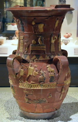
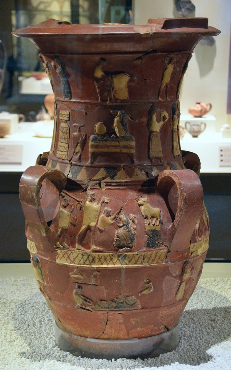 cBCE1600 Hüseyindede Tepe ᴷH•ãrꞋri-ᴷHatᵊtūshꞋa wine-mixing urn, later adapted by Greeks to the krater 𒁉𒁇𒌋 (later Greek κρᾱτήρ) ??? Placed near center of room, used by wine stewards to fill participants' κύλιξ (kūlꞋix; wine cup—see link). Bibru 𒁉𒁇𒌋 equates? to Greek krater https://en.wikipedia.org/wiki/Krater (Form and function) "At a Greek symposium, kraters were placed in the center of the room. They were quite large, so they were not easily portable when filled. Thus, the wine-water mixture would be withdrawn from the krater with other vessels, such as a kyathos (pl.: kyathoi), an amphora (pl.: amphorai),[1] or a kylix (pl.: kylikes).[1]" & https://en.wikipedia.org/wiki/Kylix --> relief, wedding musicians & dancers (İnandık Turkey; clay mixed with gold mica, 86cm (2' 10") h x 50cm (1' 8") diam)
 cBCE 1500 ᴷHat•tūꞋshan KᵊrētꞋë; clay octopus flask (ArchMusHerakleion)
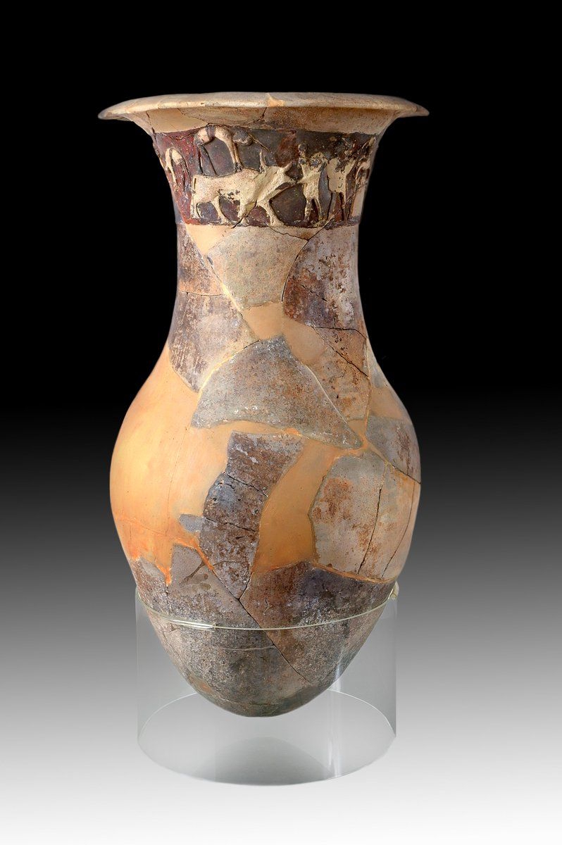 cBCE 1650 The neck frieze depicts bull leaping inherited from the ᴷH•ãrꞋri / ᴷHatᵊtūshꞋa / Kit•imꞋ (Çorum Mus., Sipah 2001)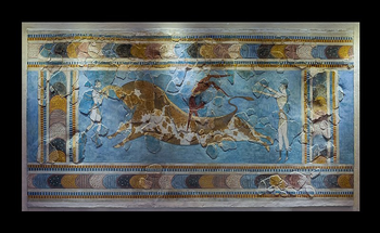
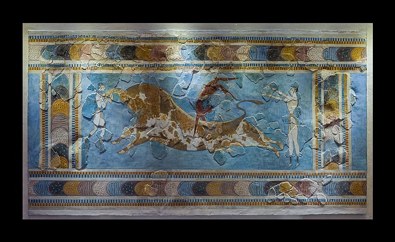 cBCE 1525 Knossos, KᵊrētꞋë ᴷHat•tūꞋsha ("Minoan") Bull-Leaper fresco; (photo: Jebulon
  )
)

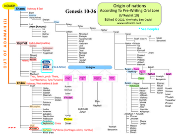
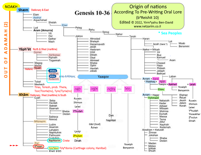 While the Table of Nations was recorded as scribes in the Biblical era understood them, they reflect good insight for that era.
 Garbles To
  To
To 
 350x250.png "Anatolia geological zones (Moix)")
 890x635.png "Click to enlarge") Anatolia geological zones (Moix), including East Anatolian Fault Zone (EurekAlert 2023.06.29)
Anatolia geological zones (Moix), including East Anatolian Fault Zone (EurekAlert 2023.06.29) 0350x385.png "Geotect 260Ma Eurasia Dardanelles Bosporus Strait Laurussia-Margin; Stampfli")
 1200x1320.png "Click to enlarge")
 260Ma: Ancient Anatolia (Modern Turkey)—followed by A•dãm•ãhꞋ (Meditteranean east coast, including Yi•sᵊr•ã•eilꞋ), Arabia & the entire continent of Africa (Geotect 260Ma Stampfli)


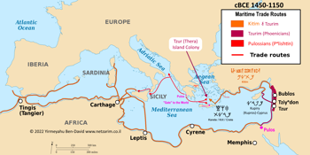
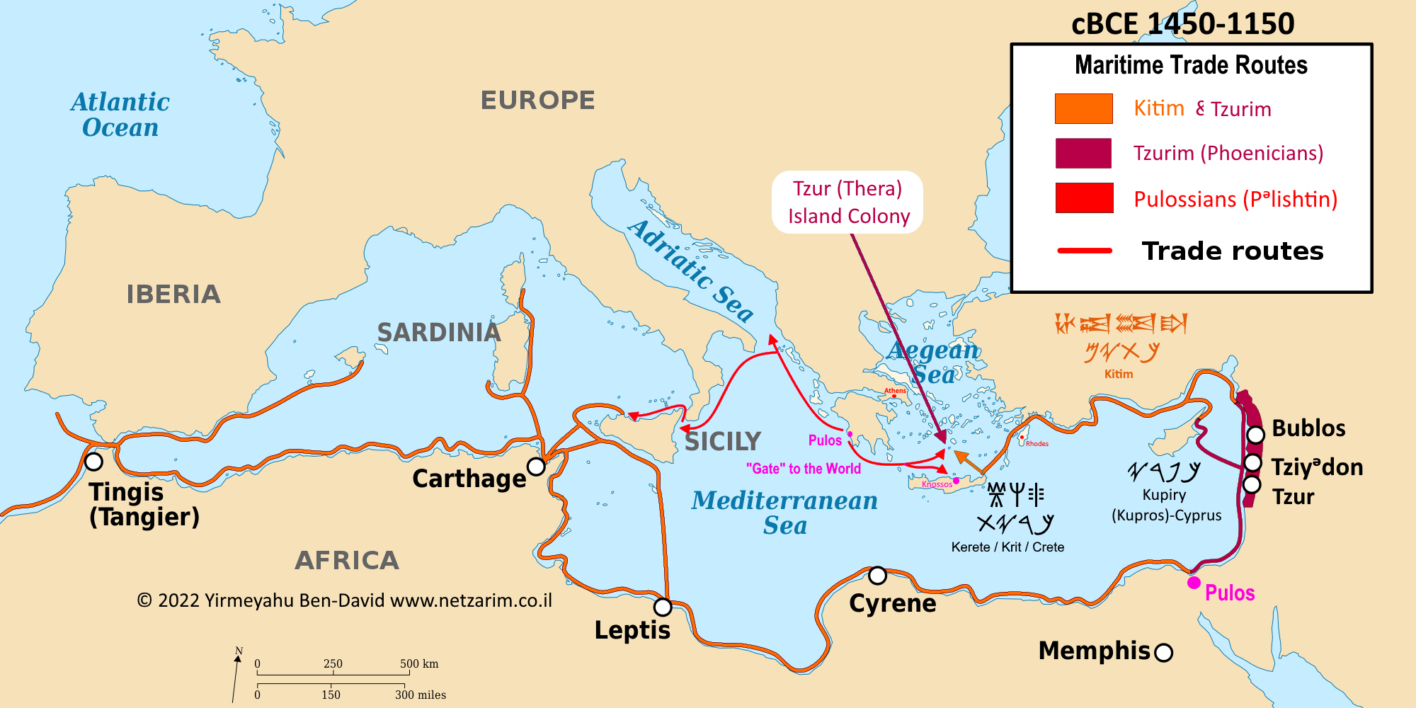 𐤑𐤓-Colony Island—Hellenized exonyms: pre-LBAC
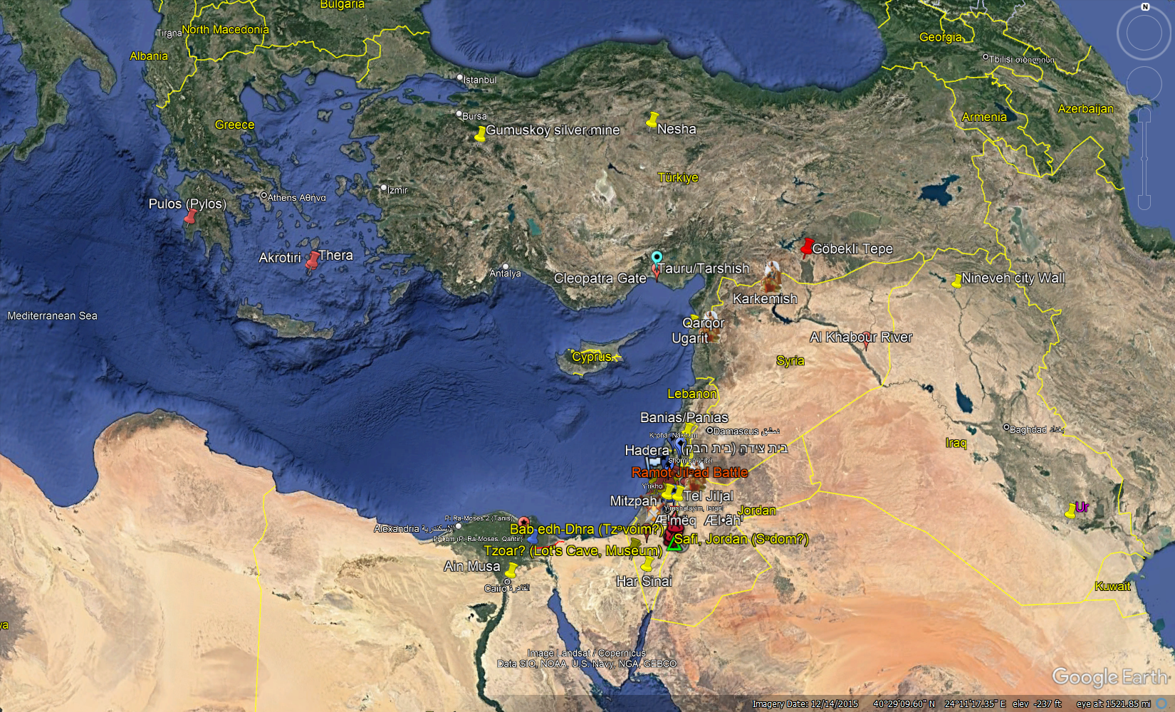 Eastern Mediterannean Basin, NëꞋshan-speaking ᴷHat•tūꞋsha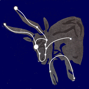
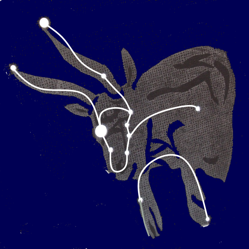 𒋫𒀀𒊒
𒋫𒀀𒊒 
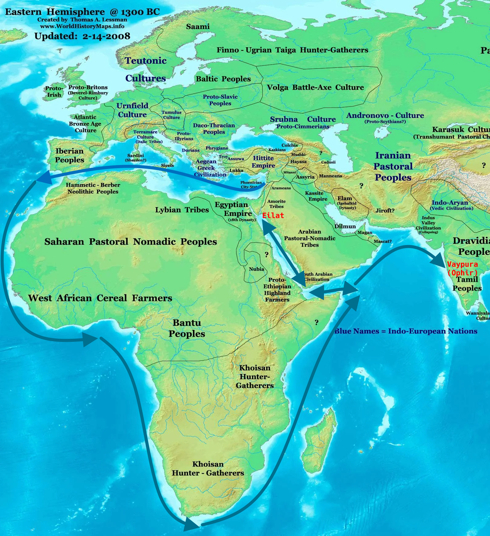 Eastern Hemisphere: From Ta•rᵊshishꞋ to Eilat & on to Ophir (modern Vaypura), India.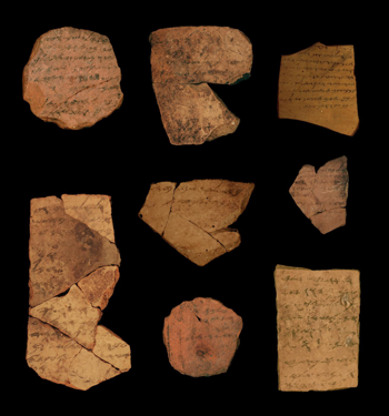
 cBCE 600 Middle Semitic Hebrew-Phoenician-Aramaic ostraca from Arad; TAU
 .
.
 cBCE14Cent 350x235.png "≈BCE14ᵗʰ Cent Kharrian-Khattusha-Kittim (Hittite)")
 cBCE14Cent 800x531.png "Click to enlarge") ≈BCE 3000–1600 Semitic Anatolians: ᴷH•arꞋri / ᴷH•ūrꞋri / ᴷHat•tūꞋsha / Kit•imꞋ — all starting with a כ (no dã•gæshꞋ in BCE Hebrew). These were wrongly transgarbled together with the חִתִּים (beginning with ח,
"Hethites") of Kᵊna•anꞋ as "Hittites")
≈BCE 3000–1600 Semitic Anatolians: ᴷH•arꞋri / ᴷH•ūrꞋri / ᴷHat•tūꞋsha / Kit•imꞋ — all starting with a כ (no dã•gæshꞋ in BCE Hebrew). These were wrongly transgarbled together with the חִתִּים (beginning with ח,
"Hethites") of Kᵊna•anꞋ as "Hittites") Greek Linear A tablets fm Akrotiri BCE1800-1450 350x165.jpg "cBCE 1800–1450 Akrotiri, Creta (''Minoan'') Greek Linear A tablets")
 Greek Linear A tablets fm Akrotiri BCE1800-1450 900x430.jpg "Click to enlarge") cBCE 1800–1450 Akrotiri, KᵊrētꞋë, early Hellenized-Semitic Linear A tablets
cBCE 1800–1450 Akrotiri, KᵊrētꞋë, early Hellenized-Semitic Linear A tablets Cyprus copper 053x19.png "Kuprians (Cyprians=Cypriots)") began during the Levantine Culture
began during the Levantine Culture Cyprus copper 101x36.png "Kuprians (Cyprians=Cypriots)") Predate The Egyptian Civilization
Predate The Egyptian Civilization
 , written in Mycenaean Linear-B Greek during the time of Shᵊmū•ælꞋ Bën Ëlᵊqãn•ãhꞋ ha-Lei•wiꞋ, ha-Nã•zirꞋ, ha-Nã•viꞋ during the Greek Dark Ages (Late Bronze Age Collapse) was associated with the PūlꞋos colony—which was on the northern coast of Sin•aiꞋ abutting the Egyptian border.

